The Range of the Awful Hand conjures up images of fire-breathing dragons, goblins and orcs. A land not out of place in the Hobbit or Lord of the Rings. The Galloway Forest park has plenty of other names on the map to get the imagination going. How about Rig of the Jarkness, Clints of the Buss, The Wolf stock, Howe of the Caldron or the Murder Hole?
I have visited the area a couple of times and I feel that it is amongst the wildest south of the Scottish Highlands. There is a lot of rugged scenery crammed into a relatively small area. It is also home to some of the biggest and baddest tussocks that you will ever come across.
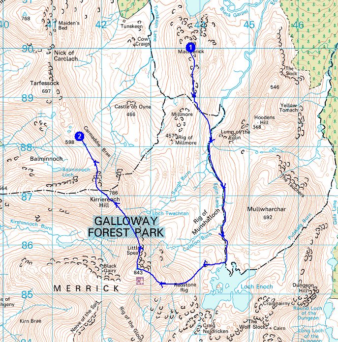
The Range of the Awful hand is so-called because the hills resemble the fingers of a hand when viewed from above or on a map. The Merrick is the highest hill in mainland Scotland south of Ben Lomond. To its north there is a series of high hills that stretch for several miles, a ridge I have always wanted to walk. It would be difficult to walk them in a day without a degree of backtracking. Therefore a couple of years ago I planned a backpacking trip, saving it for a spell of settled weather. This finally coincided with the first weekend of June.
Although the Galloway Forest park is located in Southern Scotland it is a long journey when travelling from the Midlands. This is because it is so far west, a good eighty miles from the motorway network.
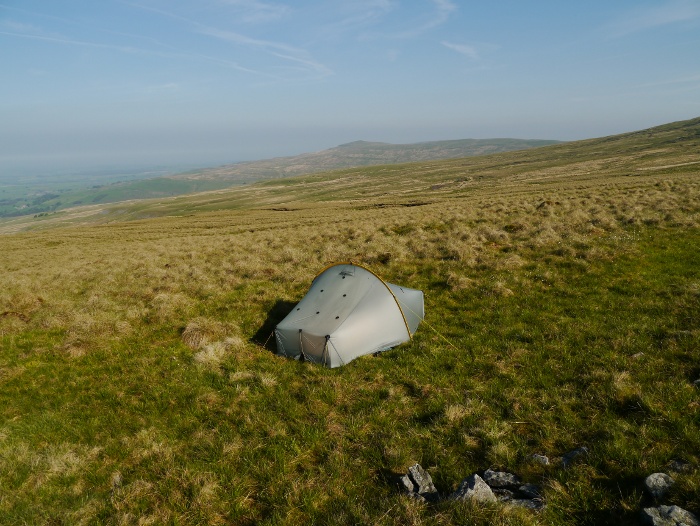
With such a long drive and the weather being good, I decided to travel after work on the Thursday and camp in the North Pennines, before continuing the following morning. Therefore shortly after 10pm I found myself parking next to the Hartside cafe on one of the highest roads in the country. I shouldered my pack and walked a kilometre or so up a nearby hill, pitching my tent at 2000ft in the last of the light.
It really should have been an idyllic moment but the peace was soon shattered by a meeting of boy racers in the cafe car park. I had a good view and watched as they proceeded to do wheel spins around the gravel before tearing off down the hairpin bends on the road. This continued for a couple of hours until they finally buggered off and I got some peace.
I suppose that peace is relative, as the moorland birds were numerous and very vocal. The evocative call of the curlew soon loses its appeal at 2.00am when it is only a few metres away! I woke early to sunshine and clear blue skies, it was good to start the day in an elevated spot with views to the distant Lake District.
Breakfast was easy that morning. Get up, pack, walk twenty minutes down hill, throw rucksack in car, enter cafe, order. It beat my usual bacon supernoodle backpacking breakfast.
Stomach happy I continued the drive to Galloway Forest Park, a final stop in the nearby and rather lovely village of Straiton. I am making more of an effort these days to spend a bit of cash on local businesses when I go out hiking. Therefore a good excuse to stop at the cafe for a toastie and a drink. By the time I pulled up at the Stinchar bridge car park it was past midday and already feeling rather hot.
Don’t be fooled into thinking this was an easy route based on the distances below. This is one tough area in which to backpack!
Day 1 – 11 kilometres with 360 metres ascent
Leaving the car it was a bit of a slog along the hot tarmac. I had walked for about twenty minutes when that sinking feeling comes when you know you have forgotten something. I had left my two litre platypus in the car. This meant that I would only have two one litre bottles for when camping on the waterless summits. I cursed but could not bring myself to turn round and get it. I would just have to make do.
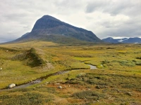
Tarmac turned into the gravel track of the forest drive. Being a Friday this was really quiet and only two vehicles passed by the time I had reached the turn off for Tunskeen bothy. Thankfully this is now blocked by a forestry gate stopping people from driving to the front door (sadly not effective on quad bikes). The shade of the forest was welcome for a while, the mountains looming on the horizon. Soon the tiny whitewashed bothy came into view.
It was good to get out of the direct sun, the dark interior providing temporary cool relief (you don’t often say that about a Scottish bothy!). The inside was in pretty good condition, if not a bit worn and tired looking. Plenty of cut wood was piled in a wheelbarrow in the corner. The bothy book gave the impression that it is a well used place, especially at weekends when it sees a bit of local party traffic.
An old bottle of lemonade was sitting on the windowsill, after emptying and giving it a wash it provided a good replacement for my forgotten water bottle. The outside of the bothy was a bit of a shit tip, bits of litter, food scraps and a couple of feral socks made me glad I was leaving. The bothy started to look a bit better once I had put in some distance, the bulk of Shalloch on Minnoch behind.
It was hard work walking the short distance to Tunskeen Lane, it was either tussocks or deep heather. The deep heather was actually the easiest to walk through. Its real ankle twisting territory, especially with a backpacking sack.
I sat in the middle of the river on a large slab, water cascading over the surrounding rocks. I spent a while filtering four litres of water for my summit camp on Macaterick, this being the nearest water source. Distributing the bottles around my pack, they really weighed me down as I made the slow and steady climb towards the summit.
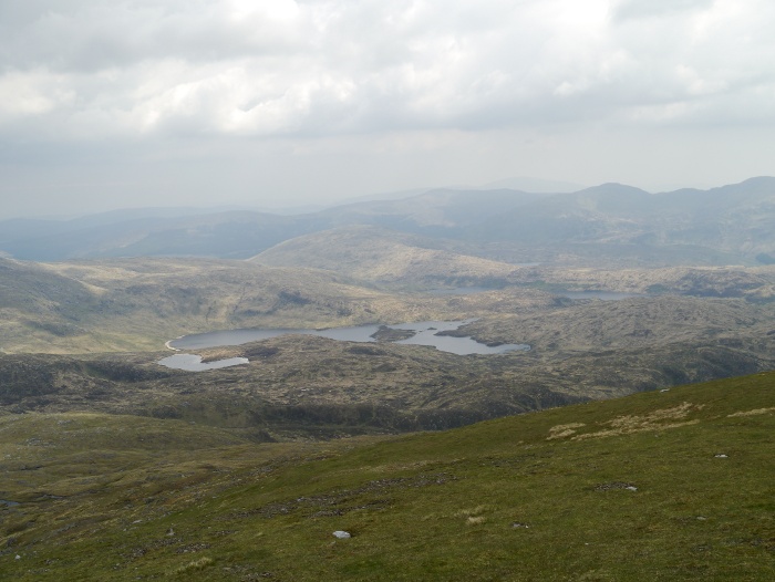
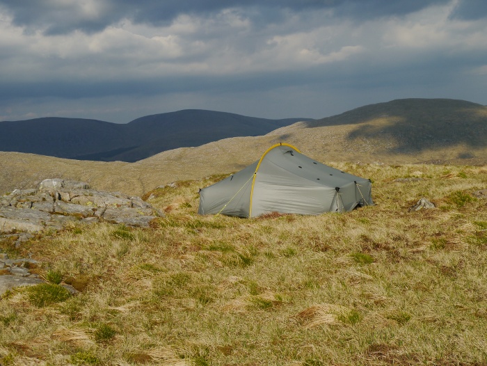
Although a hill I had previously not visited, it is somewhere I have fancied camping as I assumed the view to the north would be good. I was right, a series of Lochs spread out below my feet, among an empty landscape. The summit was pretty rough but I managed to locate a small patch of flat grass and got the tent up.
Pitched early and with water already fetched I spent the rest of the afternoon lazing in and around my tent. Time spent in between gazing at the view and reading my kindle.
As afternoon turned to evening the light became softer, the low light picking out shadows and textures on the surrounding hills. I wandered around with my camera for a couple of hours snapping away as everything took on hues of yellows and then reds. It is one of those evenings which is hard to capture with words so I will let a few images do the talking.
The best thing was that it was summer, warm and not a single midge in the sky. What more can you ask for? The weather was so good I went to bed with the tent fully opened, the view from my sleeping bag stretching the length of Loch Doon.
Day 2 – 10 kilometres with 700 metres ascent
I slept surprisingly badly, probably down to the fact that it did not get properly dark. I woke just after 4.00am, turned over and was greeted by the sun peeping over the horizon. There was a thin layer of mist in the valley below. I really should have got myself up and started snapping away. Instead I sat up, took a photo whilst still in my sleeping bag and then turned over and went back to sleep.
It’s not often that you get forced out of your tent at 7.00am from the top of a Scottish hill by the heat. It was a novel experience but by the time I was packed at 9.00am it felt absolutely sweltering. I set off along the south ridge of Macaterick under blue skies, a few fluffy clouds beginning to bubble up.
Descending towards the Elgin Lane I was soon floundering amongst the heather and tussocks. In this sort of terrain I find it harder to descend than climb up hill. The momentum along with a heavy pack makes it easy to misplace your footing, especially when there are loads of holes hidden in the vegetation.
My plan had been to climb the other side of the valley to the summit of Mullwharchar. However I decided I could not be bothered and the heat was getting to me. I have spent the night camped on its summit before so consider it well and truly bagged. I noticed a narrow animal track along the river bank so decided I would follow it to Loch Enoch.
Close to the Loch I found a comfy perch, got the shoes and socks off and got the stove on. It was clear that it was not going to be a big mileage day so I was content to pick the fluff out of my navel and stare vacantly at stuff. The surrounding stuff was very scenic.
I decided that I would climb the Merrick via Redstone Rig instead of the main route via Benyellary. Walking along the shore of Loch Enoch I was suddenly confronted with a pair of buttocks. The owner was standing buck naked on a sandy beach, hands on hips. He was far enough away for me to slip by unnoticed, therefore I did not have to engage in awkward conversation. Starting to climb I looked back and he was looking my way, thankfully dressed in underpants. Five minutes later I looked back and he was once again exposing himself to the empty loch. At least it was a warm day for it!
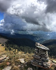
Although warm the skies had clouded over, distant scenery disappearing in the murk. It felt a bit of a slog climbing to the summit, but the higher I got the better the views over Loch Enoch.
I reached the summit a tired and sweaty mess at the same time as a young couple. The woman was dressed in denim hotpants, t-shirt, pumps and designer glasses, looking like she had just popped off the catwalk. No sign that she had walked up a 843 metre mountain. I on the other hand was covered in peat, red in the face, out of breath and perspiring heavily. I felt a right plank. A slightly overweight and middle-aged one.
I scuttled off awkwardly and marvelled at the view instead. Despite the gloomy conditions it was a good one.
The trig point was absolutely covered in copulating beetles, the surface teeming with them. I was particularly taken with the enthusiasm of this fivesome. Anyone know what they are?
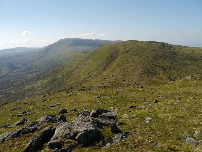
North of the Merrick the ground drops away steeply with a fairly narrow ridge leading to the subsidiary top called Little Spear. Tough on the knees but now I was up high the going was easy on short-cropped vegetation.
From Little Spear I dropped down to a col and started the ascent of Kirriereoch hill with good views back to the Merrick.
Kirriereoch hill has a large grassy plateau, the only feature being a drystone dyke that runs across the summit, this gave shelter from the breeze whilst I had an enjoyable laze about.
I really was not prepared for the steepness of the descent. It looked doable on the map but from the top of the slope it appeared vertical. I spent what felt like an age picking my way down very steep bouldery slopes, occasionally backtracking to pick a safer route. I have to say that trail shoes are rubbish for this sort of thing. It’s when large, heavy leather blocks come into their own.
I had Elvis legs by the time I got to the bottom and was keen to pitch. It was early but there are loads of small lochans on the wide ridge leading to Tarfessock. An easy water source for a wild camp. I picked a good spot close to steep slopes, giving great views down into the central Galloway badlands. With water filtered I enjoyed another lazy evening watching the light change, the clouds getting darker before dissipating at dusk. Another cracking spot.
Day 3 – 9.5 kilometres with 380 metres ascent
I was up and cooking breakfast at 6.00am, exceptionally early for me! Even at that hour it was warm in the sun which was already high under a flawless blue sky. Looking to the west the quality of the light was beautiful and pin sharp. Every feature in that direction looked close enough to touch. This meant that the wind turbines that had been hidden in the murk the day before were gleaming white. From faint outlines they were now the dominant feature in that direction.
I turned my back and looked east instead, over the wild Galloway heartland. With the sun rising in that direction, the light took on softer tones giving the hills a velvety texture. Sadly in the far distance the hills to the east resembled giant pin cushions. The gentle rolling contours of the Southern Uplands now prickling with hundreds of turbines. The wild places of this part of Scotland are diminishing at an alarming rate. Soon the wild core of the Galloway hills will be a small, rugged island sitting in a sea of industrialisation.
My immediate surroundings however were superb and I had them all to myself. I just knew that would be the case until I descended to the car.
Without a hint of a breeze the dreaded midge decided to put in an early morning appearance. Not a real menace but just enough to mar a perfect breakfast. I still managed to dally and it was nearly 8.00am by the time I had packed and was on my way.
The walk to the southern top of Tarfessock was easy, the vegetation short and the ground dry.
There were some bizarre sights on the way to the main summit of Tarfessock. I kept coming across piles of sharpened sticks and posts with duct tape wrapped round them. These were at random intervals along the ascent. I also found empty smoke canisters and a crudely constructed shelter which was all of six inches high. There were also loads of discarded fag packets. Some odd people must stalk these lonely hills.
A decent to the Nick of Carlach and then what felt to be a very long climb to the summit of Shalloch on Minnoch. The view back to the north was outstanding, a great excuse to stop and get my breath back.
The summit of Shalloch on Minnoch is broad and grassy, cropped short like a bowling green. It would be a featureless place in poor visibility. The true summit is a couple of hundred metres away from the trig, a point worth remembering if you are a sad hill collector like me. The best viewpoint was from the cairn to the north. I did not take a photograph looking to the west. In a turn of the head I counted over one hundred and thirty huge wind turbines (many not turning) in that direction. Plenty more are currently planned for the hills and forests to the north.
A long grassy descent followed by a short boggy climb took me to the north summit of Shalloch on Minnoch. As is usual in these hills the lower the altitude the thicker the vegetation. Cropped grass soon gave way to tussocks and heather.
By the time I was approaching Cornish Loch I was hot and rather fed up of lurching through the vegetation. It was all a bit too much hard work to be honest. It took ages to walk any distance at all. I was rather relieved to finally reach a path.
I don’t know what happened but I meant to take a path leading directly back to the car park. Somehow something went wrong and I walked in the opposite direction for far too long. Thankfully I ended up on the minor road a kilometre from the car park. I cursed my lazy navigation. As always when leaving the car for a few days in an isolated spot I was pleased to find it waiting for me in one piece.


