Posts tagged ‘Howgill Fells’

October 18, 2013

Howling in the Howgills – backpacking south to north

by backpackingbongos

I have to admit that I was hard pushed to locate Great Asby on the map.  Chrissie has been cherry picking the best bits from the Dales Highway and invited Reuben the mountain staffy and myself to join her for a weekend.  The plan was to do a linear walk from Sedbergh across the Howgills and into little frequented limestone country to the north.

With modern technology there was no need to locate Great Asby on a road map.  I punched its name into the sat nav and headed the car in the direction I was told.  It turns out that it is a charming village and I parked up next to the church.  Moments later Chrissie’s husband Geoff pulled up in their campervan and drove me south to Sedbergh to meet Chrissie and Dixie.  The campervan turned into the cheapest tea van in Cumbria before I set off with Chrissie, Dixie and Reuben.  Geoff would meet us in Great Asby the following afternoon.

Howgills

Day 1 – 10.5 kilometres with 680 metres ascent

Howgill Lane took us out of the town and we were soon climbing the steep bridleway past Lockbank farm.  The initial ascent was an absolute killer for me.  Lack of fitness plus a recent worsening of my asthma meant that I was soon gasping for breath.  Luckily the increasing views gave plenty of excuses to stop, the rooftops of Sedbergh glinting under shafts of sunlight.

As we contoured around the southern slopes of Winder the wind hit us.  It was strong enough to make the taking of photos difficult without everything becoming a blur.  The path soon levelled out a bit and we could see the route ahead to Arant Haw, occasionally being brushed by clouds.

P1050867

A second lunch was grabbed just below the summit, the leeward slopes being surprisingly sheltered.  A guy we had passed earlier had warned us about just how windy it was on the tops.  It was good to have a rest before the promised battering.

The summit was quickly gained but we did not stop except to dig out gloves.  The ridge narrows slightly at Rowantree Grains, giving great views down into Bram Rigg Beck.  The clouds swirling above were highly atmospheric but unfortunately the higher hills ahead were stubbornly covered.

P1050873

P1050876

P1050878

Climbing up towards Calders the wind increased dramatically as it was funnelled between a narrow col.  I got out my wind measuring thingymajig which measured an average wind speed of 44 mph, the strongest gust being 49.7 mph.  The climb was tiring and at one point the wind made me lose my balance and I found myself on the deck.  Another effect of the wind was to have a horizontal trail of nose juice blowing across the fell side.

The trig point of the Calf was hidden in thick dank cloud, damp enough to warrant waterproof trousers.  Once again we did not hang around and quickly set off along the bridleway that would take us down into Bowderdale.

There was a surreal moment when we saw a strange shape loom out of the mist, to me it looked like a misshapen cross.  It turned out to be two backpackers huddled together consulting their map.  They both jumped when Reuben appeared out of the murk at speed to say hello.

Thankfully the wind dropped a little as we descended into Bowderdale, however the cloud was sitting lower on the hills, the air full of drizzle.  A wild and lonely looking valley in the conditions.

P1050881

We followed the path down the valley for a while, eventually picking a flattish spot to camp next to the river.  The wind was gusting again, being funnelled directly up the valley.  I was pitching my new Kifaru Megatarp for the first time out in the wild and the wind did not make things easy.  I eventually wrestled what felt like a hundred metres of fabric into position, pinned firmly down with a grand total of 21 pegs.  It was not going anywhere.

P1050886

Along with the Megatarp I had purchased the Tarp Annex which transforms the shelter from a tarp to a four season shelter.  This has a stove boot sewn into it to take the small Kifaru woodburning stove.

It was not yet cold enough to bring along the woodburning stove.  I also did not want to risk using it in strong winds, a lightweight chimney being blown about would just be asking for trouble.

P1050887

The weather meant that we were soon in our individual shelters.  It was dark by 6.30pm which felt really early after a summer of wild camping.  Although stable the Megatarp was a bit noisy, there is a lot of fabric to catch the wind.  The plus point was that I had plenty of room to spread out inside, the evening passed quickly with a good book.

Day 2 – 17 kilometres with 280 metres ascent

One of the main problems of sleeping in a floorless shelter is that my pillow seems to go walkabout in the night.  At least in the confines of an inner tent there is nowhere for it to go.  I kept waking to find that it had pinged off somewhere, the downside of a lightweight inflatable pillow.

The rain stopped soon after midnight but the wind continued to increase towards dawn, howling up the narrow valley.  Chrissie came along to wake me around 8am and we had a leisurely couple of hours around camp before packing and setting off at 10am.

P1050891

The last time I had walked down Bowderdale was with Martin Rye during a stormy January weekend a few years ago.  Then Bowderdale beck was an absolute raging torrent, even the small side streams proving difficult to cross.  We urgently headed down the valley half expecting to find our cars washed downstream.

Although windy the conditions this time were much more benign and it was good to get an actual view of this long and remote valley.

P1050892

P1050894

P1050896

A dry stone wall provided shelter for a snack break before we headed through the hamlet of Bowderdale and crossed the busy A685 via an underpass.

Access land is marked on the map next to the building at Rigg End, however it proved very difficult to actually access.  A gate in its final years of life was tied to an equally ancient fence post by numerous ancient pieces of twine.  It took a fair bit of patience to pick it all apart whilst Dixie decided she wanted a quick fight with Reuben.

Once through it was a pleasant plod through moorland following a track on the map which no longer exists on the ground.  Perhaps everyone has been put off by that gate.

P1050898

As we were descending towards a bridge we saw Geoff and Tilly in the distance.  Tilly spotted us and came bounding over at great speed, the usual happy labrador.  It turned out that Geoff had spent a while trying to find us on our route.  However he had managed to become geographically challenged on the way, muttering something about how the map was wrong.  When unsure of your location it is always best to blame the Ordnance Survey.

Lunch was taken before climbing onto a lovely area of limestone pavement.  The views back were of the northern Howgills, their summits covered by a uniform blanket of cloud.  Fingers crossed that the rain would hold off until we got back to our vehicles.

P1050902

Tilly and Reuben behaved splendidly through an area of four-legged woollies, taking not a blind bit of notice of them.  They were too busy larking around, Reuben’s terrier instincts meaning he won tug of war with a stick and stole Tillies ball.

This wedge of limestone country between the Howgills and the Eden valley is worthy of exploration if you are looking for a bit of peace and quiet.  It would be lovely on a warm summers day with sky larks singing overhead.

P1050907

The final section of the route took us down through cattle infested territory.  Most were fine until the final field where one started to take offence at the dogs, the field being full of surprisingly young calves.  We all got over the stile in time and no harm was done.

The skies opened a few minutes before reaching the village where the best tea van in Cumbria was waiting for us.  Coffee and homemade apple pudding set me up for the long drive home.

You can read Chrissie’s version of the trip here.

July 20, 2011

Backpacking bloggers in the Howgills

by backpackingbongos

Day 1 – 5.2 miles with 470 metres ascent

I did a couple of circuits of Ravenstonedale looking for a spot where I would be happy to leave the van for two nights.  By the time I actually parked up I had no idea how my location actually related to the map.  I feel a bit ashamed to admit that I powered up the mapping on my iPhone to determine my exact location.

It was early afternoon and I had arranged to meet Martin and Terry at a high level camp later on that evening.  I had previously backpacked with Martin and we had got along well, I had yet to meet or speak to Terry.  However after reading his blog and watching his videos for a while now I had a firm image in my mind what he would be like.  He lived up to those expectations in the flesh!

With my map now following the reality of what was on the ground I located my first footpath with ease and crossed a field.  I was immediately surrounded by the friendliest lambs I have ever come across.  They all crowded around me, pushing and shoving to see who could get the closest.  One even nuzzled my knee and was up for a good stroke.  This put a big smile on my face as I made my way along lanes to the A863.

The weather however soon removed my smile as I fully kitted up in waterproofs whilst watching the clouds get lower and lower on Wild Boar Fell ahead.  A steady drizzle soon gave way to a downpour on my climb up the bridleway that eventually leads to Mallerstang.  I found temporary shelter under a band of trees and stood watching the cows as I loaded up on fuel for the long climb ahead.  From the Limestone pastures of Stennerskeugh Clouds I looked towards where Sand Tarn was located, hidden from view by the mist.  I took a bearing to a cairn on the horizon and descended across marshy ground before ascending the grassy hillside.  The clouds were lifting by the time I reached the tarn, ragged tendrils drifting across its surface.  It looked a dark and foreboding place the shifting mist providing a gloomy atmosphere.  I located a spot for the tent, pitched up and laid down for a while.  My empty thoughts were soon disturbed by a brightening though the nylon and I peered outside to see the sun weakly piercing the clouds.

With a change in the weather came a change in atmosphere around my high wild camp, it went from dark and brooding to bright and friendly in less than an hour.  I sat and cooked my dinner and and ate it on a rock overlooking my ascent route.  In the distance I spotted two figures slowly make their way toward me, disappearing from sight every now and then as the moorland dipped.  Finally Martin and Terry appeared over the final rise and wandered over to say hello.  Tents and shelters were erected and we spent the evening in awe at the spectacle that nature laid on for us.  The ever-changing light was magical as the sun made its slow progress towards the horizon.  Sand tarn soon became a very inviting spot indeed.

I think that we must have taken hundreds of photos between us that evening, it was hard to resist snapping away constantly.  We wandered around camp for hours chatting about days in the hills and kit, pulling on more and more layers as the air chilled around us.

Just before the sun finally disappeared from sight we started guessing what the temperature was.  It felt cold, far colder than I have ever experienced in June.  My watch left in my tent said that it was 3 degrees celsius.  We were all glad we had brought along warm down bags that night.

Day 2 – 11.1 miles with 870 metres ascent

We had hoped, almost expected to wake to a spectacular inversion.  Mist had started to form in the valley the evening before and the air had been clear and totally still.  The inner of my tent was soaked with condensation, in some conditions this is totally unavoidable.  The climb to the trig point on Wild Boar fell was steep but short.  A great spot but the best of the views are hidden by its extensive plateau.

However a couple of minutes walk away the ground plunges steeply into the valley of Mallerstang.  An outcrop of rock called the Nab is the perfect spot to stand and linger whilst taking in the views.

The eastern escarpment stretches for roughly a kilometre, bringing a bit of drama to the usual soft folds of the Pennines.  Tall slender cairns look like people standing by the edge from a distance.

It was a relaxed walk towards Swarth fell, easy chatter about the stuff that backpackers find interesting, common interests shared.  Lots of time to take in the wild and deserted landscape.

The original plan had been to ascend Baugh fell but we were all tempted to explore the hidden delights of Uldale, a world of gorges and waterfalls, hardly hinted at by the map.  An easy grassy descent led to a crossing of the infant river, it was a case of ignore the map and seek out the best line down the valley.  Terry had come this way before so took the lead.

We contoured steep slopes high above the river hidden below.  It was hard slow going, the calling then sighting of a Red Kite adding to the experience.  Suddenly we were on the edge of a large sheer drop, the sound of a hidden waterfall below us.  A steep descent and a bit of muddy scrambling brought us into a secret oasis, a deep pool surrounded by luxurious vegetation.  A small cascade fell into the pool whilst behind, partially hidden from view a large waterfall plunged into a rocky amphitheatre.  A truly lovely spot.  Terry was the only one to brave a slippery traverse of the rocks above the pool to get a closer look.  Food was eaten in the sun until a heavy shower got us packing and on our way.

We stuck to the valley bottom as best as we could until a wide grassy bridleway lead us high above the Rawthey valley, the view towards the steep grassy Howgills becoming more dominant with every step.

There was talk of food and ice-cold cokes on the descent to the road and it was suggested that we see if the Cross Keys Temperance Inn was open.  Thankfully it was and we were soon sitting on the back patio with pints of coke and bowls of chips.  We were aware of the steep climb ahead of us to the summit of Yarlside, a hill that has a bit of a reputation for its exceptionally steep grassy slopes.  It can sometimes be difficult getting back up and backpacking after a good feed and sit down but we were soon making swift progress up the path towards Bowderdale Head.

Cautley crags and the surrounding hills looked like they were covered in green velvet, the greenness of summer must surely have been at its peak?

A group was passed at Bowderdale head and a guy made a comment that we must be sponsored by Rab.  I have to admit that we were all pretty much dressed head to toe in the stuff!  By the way I am not sponsored by Rab but if they would like to sponsor me…………..

It was steep and slow going as we climbed Yarlside.

The summit gave amazing views of line after line of hills spreading into the distance.  Looking west there was no suggestion of the hand of man, walls and fences being absent from this cracking little range of hills.  The sky was moody and broody and we watched showers as they tracked their way across the landscape.

Terry made the suggestion of a camp high on the summit, to sit in our tents and stare at the views would be a great way to pass away the evening.  There may even be another sunset treat.  The wind however would have made it unpleasant and myself and Martin persuaded him that a sheltered camp would be a better idea, even if we lost the views.  The descent to the saddle between Yarlside and Kensgriff is exceptionally steep.  A slip in wet weather here could potentially be serious, you would slide down the cropped grass with speed.  We descended in a row just in case someone did slip, that way they would not take anyone else down with them.

The flat spot that we identified was not as flat as it looked from higher up the hill.  Once the tents were up it started to rain which it continued to so on and off for the rest of the evening.  Once again it was cold and I felt like I was dressed for winter.  Terry had brought a special beer dispensing rucksack with him on this trip, a ready supply of cans being produced each evening.  I am sure that the taste of beer on a wild camp would have been very pleasant, but I never found out 😉

Day 3 – 4.9 miles with 270 metres ascent

We were up and out of our tents by 6.00am.  The cold and rain of the night before being replaced by a bright sunny morning, the warmth already being felt.  A time to appreciate our camp spot, something we had not been able to do before.

We were walking by 7.00am, something that I rarely do.  The light soft and clear bringing out the textures of the surrounding hills.  It was worth getting up early for.

Various sheep trods helped us as we contoured along the steep slopes of Kensgriff.  It was a steep pull in the increasing warmth to the col below Randygill Top.

The ascent was best summed up by Terry.

Once up high the walking along a good path to the trig point on Green Bell was easy.  A last chance to take in this unique range of hills.  I mapped out some future routes in my mind and we talked about the possibility of a backpack that took in all the summits.  That would be a challenge, not so much in distance but in all the steep ascents and descents that would be necessary.  I think that would make a cracking long weekend.

We left the path at Knoutberry and made our way down easy pathless slopes to Ravenstonedale.  It was still early morning when we arrived at the village shop to buy cold drinks.  The village looked idyllic in the summer sunshine.  We were lucky to get such a perfect weather window that morning as on the drive home it tipped it down.

All in all an enjoyable and relaxed backpack with good company.  You can read Martin’s account of the trip here, and Terry’s here.

January 24, 2011

24 stormy hours in the Howgills

by backpackingbongos

A plan was hatched before Christmas with Martin to get in some training for the TGO challenge.  Get some miles and hills under our belts and test the gear that we each planned on taking.  The weather forecast the week prior to meeting up was not looking good and there were email discussions of Plan A’s and plan B’s.  In the end we decided to just have a plan A and see what the weather threw at us.  The Howgill fells are easy to walk out of within a couple of hours, if it got too bad we would stay low and head back home.

We hoped to meet up with Mike and Bruno on the morning after our wild camp.  Mike forecasted that we were doomed…………..

Day 1 – 7.9 miles with 600 metres ascent

It was an early start to get to our rendezvous at the alloted time, the Bongo being rather thirsty if I do any more than a quick trundle up the motorway.  I arrived at Bowderdale Foot ten minutes early and Martin had phoned to say he was seeking out a bacon buttie in Tebay.  Time for a quick brew and some breakfast in the van.  Parked up on a grassy verge I asked a farmer passing on his quad bike if it was ok to leave vehicles here.  He did not even bat an eye when I said that we were heading up onto the hills to camp, he just warned me to be aware of gales tomorrow and said a couple headed off with large packs the day before.  I feel more confident leaving the Bongo in remote areas after receiving the ok from locals.

Martin duly arrived and we kitted up, the weather already was damp, gloomy and a bit on the breezy side.  We stepped off the road onto the boggy bridleway into Bowderdale and were almost immediately enveloped in mist.  No views backwards, forwards or side to side.  It would remain that way until dropping down to camp later on that afternoon.  When the wall ran out we peeled off the bridleway and headed uphill towards West Fell and the long old ridge that would eventually lead to the summit of The Calf.  We soon got into a nice steady pace and the conversation flowed easily.  The TGO challenge and routes were discussed alongside blogging and the usual kit talk.  As we climbed higher the wind got stronger and words would get torn out of our mouths and dispersed onto the surrounding fells.  Approaching Hazelgill Knott we were staggering around like drunks, so after contouring its slopes we sought shelter in the lee of the hill for a quick snack and chat.

We both cooled down quicker than anticipated so we continued on up the ridge trying to imagine what the views would be like.  Long grassy slopes are not the most fascinating places to be in poor visibility and a few checks of the compass ensured we were on track.  It was a case of heads down and plod on.

Suddenly a strange apparition loomed out of the mist.  To me it looked like an elephant standing head on to us, my heart did a little skip and then the elephant divided into two.  It turned out to be a couple with huge packs bent over a map!  Quick greetings and we turned onto the main Calf track and found the trig point, luckily just where we expected to find it.  Martin phoned Mike to confirm that the weather was indeed rubbish and arranged that we would meet him at 9.00am if the weather was not too bad the following morning.  At that point we were still being wildly optimistic!

The aim then was to find somewhere to camp within striking distance of Bowderdale head, close enough to meet Mike in the morning but with as much shelter as possible.

The bridleway down to Bowderdale head was easy to follow in the mist and we could sense the steep slopes to our right, eventually plunging down to Cautley Spout.

Readers of Martins blog will instantly recognise the profile above from the self timed photos he posts, indeed this is how I recognised him profiled against the sky when I bumped into him in the Lakes.  I have to say that I tried my best to get a photo of his face but his mystical powers ensured that they all came out blurry.  I can assure readers that he does have a face!

Just below the mist the higher reaches of Bowderdale felt like a wild spot, we almost could have been in a remote Scottish glen.

It was time to find a place to camp, hopefully sheltered as even here down in the valley the wind was gusty.  A few pitches were identified but the gusts were too strong.  We continued on down the valley to the nicely named Randy Gill where the air was as still as it could be.  Unfortunately there were no ideal spots big enough to accommodate two tents.

Crossing and recrossing the river we eventually settled on a spot on a shelf above the river.  There was a good strong wind blowing but it would have to do, darkness falls early and quickly in January.  Tents that are good in the wind still have to be put up in the wind and until poles are threaded and pegs positioned it is just a flapping bit of nylon.  Martin was testing his trailstar shelter for the first time in the hills and I have to say that it was amazingly stable, an equal to the Scarp1 with its three poles.

Some time was spent chatting under Martins shelter but before long I was feeling chilly so retired to my tent to change into dry clothes and get some hot food into my stomach.  There was a brief respite for a couple of hours when the wind stopped gusting and the sky cleared with a bright moon shining.  A false sense of security……………………..

Day 2 – 3.8 miles with 70 metres ascent

The wind built during the night, getting stronger and stronger, then around midnight the rain joined in the assault on our camp site.  Steady strong winds buffeted my tent all night with stronger gusts tearing down the valley at random intervals.  These sounded like trains roaring towards us, getting louder and louder until the full force hit the tent.  The rigid structure did not flap but shook as a whole, the air pressure changing inside with each gust.  The rain came down all night in bucket loads and I drifted in and out of sleep waiting for the fateful moment when a pole would snap.

7.30am my alarm went off and it was still dark, I popped my head out of the door into a violent grey world before retreating back into the dry sanctuary.  A coffee and some noodles before I was greeted by Martin, it was immediately agreed that we would bail out.  It was not a day to be on the hills, or even in the hills.

This is what my world looked and sounded like at 8.00am that stormy morning.

Tents packed safely away we examined the river which was now a foaming torrent and impossible to cross, anyone falling in it would be swept off their feet and carried rapidly downstream.  Instead we found a sheep track that contoured around the hillside.  Descending back down I had a nasty slip, my leg twisting at an angle behind me.  A jolt of pain but luckily I was able to get up and continue walking, it was not a day for being carried out.  Randy Gill was now in full spate, even though its source was less than a kilometre away the speed and volume of the water was astonishing.  The depth and speed would have meant being knocked off your feet if attempting a wade, a jump was the only way.  Martin had the height advantage and crossed with ease, I faltered and found it difficult to sum up the courage.  In the end I took off my pack and threw across to Martin before doing a running jump.  My heart was in my mouth for a few minutes afterwards.

The steep hillsides were literally streaming with water, large streams appearing that were not marked on the map.  It was slow going with any flat bit of ground being totally waterlogged.  A group of fell ponies added beauty to the bleak scene.  Bowderdale Beck lower down had burst its banks, a huge dirty brown swirling mass of water.  We began to worry that our vehicles parked next to it down stream would get washed away.  The track that would lead us back to our vehicles was finally reached and we began to climb out of the valley just as further gusts tore at us, we had to brace ourselves and let them pass.

Luckily at the road head we could see our vehicles sitting happily where they had been left, although next to a river that was swollen and angry.  It was almost exactly 24 hours since we had left them, 24 hours of wind, rain and mist.  I would have much prefered sun and frost but it was great to experience weather like that and emerge unscathed.

January 15, 2010

Avalanched in the Howgill Fells

by backpackingbongos

With the exception of accidents whilst trying to drive to them, we can forget how dangerous the white stuff can be in the British mountains.  Avalanches are often a hazard in the Scottish Highlands and there is the excellent Avalanche information service website which gives a forecast of the conditions.  But an avalanche in the Howgill fells?  Jake Morgan has written an excellent post on his blog about being caught in one last weekend.  Well worth a read.

February 25, 2009

Tents in bleak places – The Pennines

by backpackingbongos

The post tents in nice places seemed to go down well so here is the follow up – tents in bleak places!

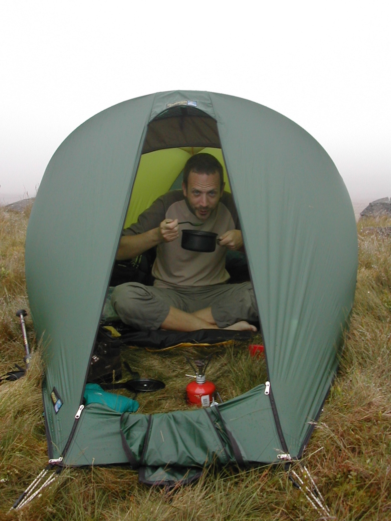
Peak District – My favourite spot on Bleaklow (Nov 2005) – can’t tell you where it is!

various-029

various-031

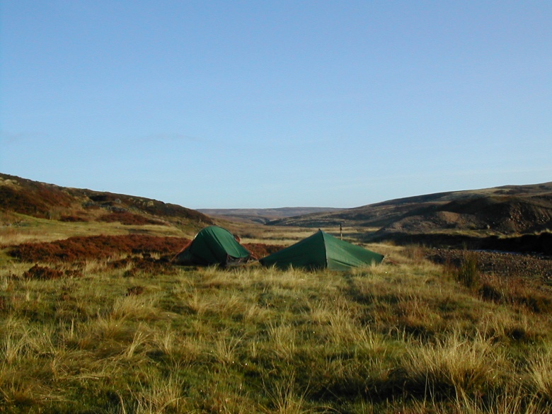
Yorkshire Dales – Gunnerside Gill (April 2007)

gunnerside-gill-003

Good morning…………………

gunnerside-gill-001

Yorkshire Dales – Jeffery Pot Scar (May 2006)

buckden-to-ribblehead-31503-to-010603-010

North Pennines – Near High Cup (Aug 2003)

north-pennines-160803-to-180803-022

South Pennines – Blackstone Edge (Jan 2006)

pennine-way-013

pennine-way-014

Yorkshire Dales – Long Crags looking towards Garsdale (July 2005)

yorkshire-dales-010705-to-030705-020

with breakfast on a misty morning

yorkshire-dales-010705-to-030705-030

Yorkshire Dales – Below Wild Boar Fell (July 2005)

yorkshire-dales-010705-to-030705-032

Yorkshire dales – The misty summit of Great Coum (July 2005)

yorkshire-dales-140705-to-150705-003

Yorkshire Dales – In the valley of Mossdale Beck (Sept 2003)

yorkshire-dales-with-rae-200903-to-210903-0091

Yorkshire Dales – Half way up Fountains Fell (Feb 2004)

yorkshire-dales-240204-to-260204-014

The Howgill Fells – The head of Langdale (Jan 2007).  And yes I know that the Howgills are not really the Pennines!

howgills-jan-07-021

howgills-jan-07-022