Archive for August, 2013

August 26, 2013

Summer slackpacking in the Moelwyns

by backpackingbongos

As I sat in the car it was rocked by the wind that was rushing unimpeded through the valley.  Soggy curtains of rain drifted down from the mountains which were hidden under a steely grey blanket of cloud.  I could see cascades on the hillside appearing from the cloud base.  It was not the sort of weather that I wanted from an August weekend.

I had parked at the end of the single track road at Blaenau Dolwyddelan, room for a couple of cars on the verge.  The surrounding fields were flooded and I sat there considering the wisdom of putting my waterproofs in the boot.  Reuben had woken from his slumber on the back seat and was keen to get moving.  The weather forecast predicted that the rain would stop at 6.00pm and for once they were spot on.  After half an hour of staring through the windscreen the rain subsided to a fine drizzle.  I grabbed the opportunity to pull on waterproofs, saddle the dog and head out into the murk.

Total distance 18.5 kilometres with 870 metres ascent

Untitled

Day one

We set off the dogs barking as we passed the farm buildings at Coed Mawr, taking the track that leads into Cwm Edno.  Climbing across the hillside we soon entered the low cloud base and although not raining the air was damp.  Thankfully we were sheltered from the wind as the clearly defined track led us into the hills and towards the Afon Cwm Edno.  The river was a turbulent mass of brown foamy angry water and I was thankful for the bridge.  It would have been impossible to cross without it.

The ground surrounding the river was waterlogged rough moorland, there was nowhere that would provide a half decent pitch for the Trailstar.  I had noticed on Geograph a small plantation a few hundred metres up the hill that appeared to have flat cropped grass nearby.  As I approached I got a bit excited when I spotted an area of short grass that was indeed nice and flat.  I was disappointed to find most of it an inch under water, despair settled in as I realised that there was not much daylight left.

I ditched the pack and wandered around the vicinity for a while looking for somewhere that was at least dry.  I settled on a patch where I could just about fit my shelter, even if there was a foot high bank to one side.  The joy of the Trailstar is how it adapts to lumpy sloping ground and luckily there was a flat bit inside on which I could sleep.  The evening was spent cooking and reading whilst low cloud brushed the top of Silnylon.

Day two

I was relieved to be woken in the morning by sunshine rather than the pitter patter of rain on the Trailstar.  Reuben was standing over me when I opened my eyes, eager to start the day (or needing the loo).  When in an open shelter I always tie him to something as I worry that I will wake to find he has gone off exploring.  On this occasion his anchor was my rucksack.

Cwm Edno was totally transformed in the sunshine, Carnedd Moel-siabod towering in front with Yr’ Arddu wrapping round the rugged upper reaches of the Cwm.  I lazed inside the Trailstar for a while but the warmth of the sun soon drove me on to pack up.  I had a long day planned that would take me all the way to the Manod hills on the other side of Blaenau Ffestiniog.

P1050525

The bridleway to Bwlch y Rhediad is marked by frequent posts, a little unnecessary as the path was clear and easy to follow.  The views to the west opened out, the Glyders and Snowdon hidden under cloud.

P1050531

P1050532

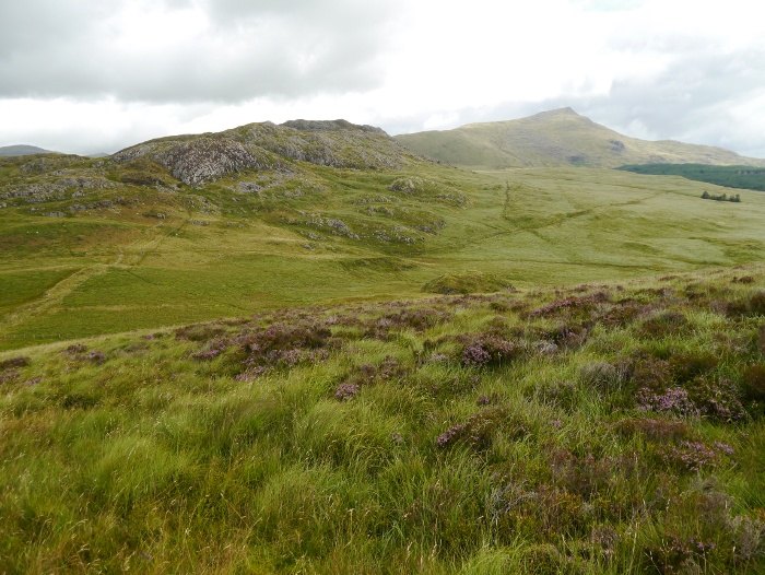
It’s many years since I walked this section of what I think of as the northern Moelwyns.  It’s wild country, unfrequented and very very boggy!  Some of the ground on the way to Moel Meirch would swallow you up whole if you were not careful.  On a couple of sections the way forward is impossible, ladder stiles taking you across the fence to drier ground.  Ladder stiles are never easy with a reluctant hound.  The boggy stretches are more than made up for with a path that winds its way round rocky outcrops and heather in full bloom.

P1050537

The summit of Moel Meirch packs a punch well above its height, which is just below the magic two thousand foot.  It’s rough and rugged, the top being crowned with crags and boulders.  Here I met the only other hikers of the day, both quick to comment on how boggy the ground was.  The views are spectacular and filled with the famous giants of Snowdonia.

P1050544

P1050545

P1050546

P1050547

P1050549

The wind was cold so we descended a little way to the east, sheltering behind a wall of rock.  I had my lunch whilst Reuben looked at me with sad eyes, insistent that he would at least get a cheesy biscuit.  He did.

P1050550

I located a narrow trod that twisted its way through the heather and descended towards Llyn Edno.

P1050554

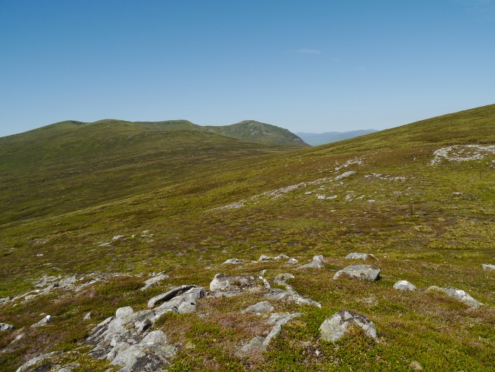
On the map Llyn Edno looks like an idyllic place to camp. The reality on the ground is bog and heather around the shoreline.  It and its environs however are rather splendid, a tamed down version of the Rhinogs.

P1050556

P1050559

P1050560

Ysgafell Wen is a long knobbly ridge of a hill, with a trio of lakes called Llynnau’r Cwn, a place I have always fancied camping.  The wind was far too strong so instead I continued on before having another rest with Reuben in the heather.

P1050562

I got a good view towards my final destination for the day, the distant hill of Moel Penamnen which sits on the other side of the Crimea pass.  I started having doubts that I would get there.

P1050567

These doubts were soon reinforced by the decoration on one of the fence posts!  Like a warning in a cheap slasher movie.

P1050568

From the summit cairn I could make out the backside of Cnicht.  Llyn yr Adar in the foreground is apparently a popular place to wild camp.  This in itself is a good reason to avoid, although it is situated in a very scenic spot.

P1050569

The route towards Moel Druman is easy to follow with a fence to lead the way through the small outcrops and numerous pools of water.

P1050572

I soon became aware that the weather was beginning to change.  A sheet of cloud was racing in from the west and the wind was picking up once again.  Suddenly I felt tired and my resolve to continue across the Crimea pass and onto another range of hills started to diminish.  I decided that if I found a good sheltered spot to camp I would stop and have a lazy afternoon.

P1050576

Things were not promising as I followed the right of way south of the summit of Moel Druman and started the descent towards Llyn Conglog.  The wind was strengthening and the cloud just beginning to obscure the surrounding peaks.  I fancied pitching next to the extensive sheet of water but that would mean an extended battering for the Trailstar.

P1050578

My luck was in however after descending along the path for a bit, the hill itself proving ample shelter from the wind.  A flat shelf of tussock free ground provided a perfect opportunity that I was not going to pass by.

Barely before I had removed my rucksack Reuben had curled up in the grass and started snoring, I think he was happy with the chosen spot.

P1050581

After pitching the Trailstar I wandered over to Llyn Conglog to fill my water bottles.  A low fence was in the way which I held down so that Reuben could hop over.  It turned out that the damn thing was electric!

Now that I carry a water filter with me when backpacking I can fill from pretty much any source, including lakes and tarns.  This gives much more flexibility in choosing a pitch as a stream does not need to be located nearby.

Once back at the Trailstar the cloud lowered even further and a fine drizzle started to fall.  I decided that I had made a good decision to stop, even though it was only 4.30pm.  Later in the evening the peace was shattered by a trio on trailbikes who filled the air with the sound of revving engines and the smell of exhaust.  It was quite alarming as they roared past only a few feet from my shelter.  That explained the numerous ruts along these usually quiet hills.

The only other excitement that evening was when an internal baffle in my Exped Synmat UL popped, leaving a curious lump for me to sleep on.

Day 3

I was woken by warm sun but continued to doze after deciding to have a short lazy day.  The Manod hills on the other side of the Crimea pass could wait for another trip.  The heat soon drove me out of my sleeping bag and I spent a while wandering round camp with Reuben.  The place was transformed in the sunshine.

P1050590

I have to admit that it was probably my laziest wild camping morning yet, with it being gone midday by the time I had packed up.

P1050593

Rather than climb Allt-fawr I decided that I would contour its northern slopes and pick up the ridge that leads to Moel Dyrnogydd.  This gave a mile or so of maximum views with minimum effort, not a bad way to start a Monday morning.

P1050594

P1050597

P1050600

P1050601

The landscape around Blaenau Ffestiniog has taken a battering over the years by slate quarrying.  It’s actually rather impressive in its scale and general grimness.  I perched with Reuben for a while and looked over the town, listening to the various beeps and one big bang that came from a working quarry.

P1050606

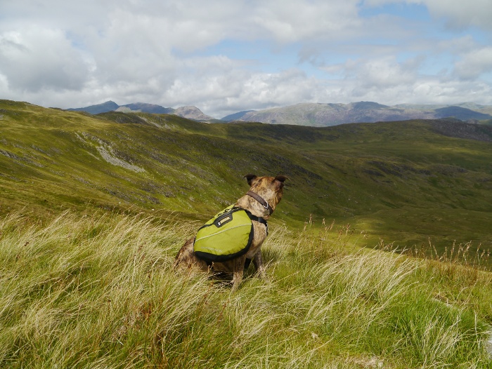
Reuben however was more concerned in keeping an eye out for those four-legged wooly creatures that roam these parts.

P1050609

We picked up a track to the east of Moel Dyrnogydd, one final stile being a test for Reuben’s agility.  He will never be famous for his climbing prowess.

P1050612

The track unfortunately leaves the right of way which disappears into a mass of bog and tussocky grass.  We continued down the track to the edge of access land and I spent a while with map in hand trying to decide what to do.  In the end I followed the track through fields and then into a farm-yard with no right of way.  Of course the farm dogs started barking their heads off but no one came out of the open front door.  Aware that I was trespassing I strided purposefully along the driveway which quickly deposited me to the road end and my car.

August 24, 2013

Glen Lyon – Meall Buidhe and Cam Chreag

by backpackingbongos

After a day on the Tarmachan ridge I returned to the van and cooked dinner.  It was a rare treat to sit outside and cook without being bothered by midges.  Using the camper van makes food much more enjoyable than when backpacking as weight is not an issue.  The only downside was that the beer I had brought with me was beyond tepid and not even worth opening.  A fridge would be a welcome addition in summer.

In stunning early evening light I headed north, descending the single track road into Upper Glen Lyon.  A long continuous downhill made me appreciate just how high my starting point for the Tarmachan ridge had been.  I have never visited Glen Lyon before and I was bowled over by it.  There is a perfect combination of pastoral beauty and rugged mountains.  None of the bleakness you get with some of the glens further north and west.

I missed the turn off for Loch na Daimh by several miles, initially thinking it was a private track.  I realised my error and returned, passing several groups of people camping along the river Lyon.  The parking area below the large dam of Loch na Daimh was busy when I arrived but I found a level spot on a grassy verge.  As the evening progressed most drove off but a few remained and pitched tents, one chap sleeping in his car.  I spent a peaceful undisturbed night in the van.

15.5 kilometres with 890 metres ascent

Glen Lyon

I was disappointed to wake to a grey and gloomy scene, the surrounding hills hidden by a shroud of low cloud.  I had checked the weather forecast the day before and it had promised hot sunshine after mist and fog had burnt off in the glens.  I had a feeling that anyone on the hill tops early on would be enjoying a spectacular inversion.

I got chatting to the guy who had slept in his car.  He had done a mammoth trek around the loch the day before, a good two day backpack for me.  He was also waiting for the cloud to lift and then would drive round to Glen Lochay to climb Beinn Heasgarnich, a huge complex beast of a mountain.

The cloud suddenly shifted mid morning in a blaze of sunshine, with rucksack already packed I was quick to set up the track that starts at an information board.  I had run out of water in the van and was keen to collect some for the day ahead.  I was disappointed to find that most of the streams as I headed east along the track had dried up, their water being diverted underground.  I finally found a trickle, wetting my cap to keep cool in the increasing heat.  The view back along the loch led my eye into wilder territory.

P1050480

P1050483

From reading guidebooks it looks like many people visit where I had parked to bag the two Munros facing each other across the loch.  This means two short there and back walks.  I toyed with this but decided it would be much more satisfying to do a longer round, settling on the Corbett Cam Chreag and the Munro Meall Buidhe.

I left the track at a wall and followed it northwards through dried-up bog.  Aiming slightly to the right of the wide ridge, outcrops of low boulders and rock made progress quick and easy as I could avoid the rough vegetation.

P1050486

P1050487

The horseflies were out in force and very persistent, I constantly had half a dozen buzzing around my head.  A few landed but were quickly slapped away only to be replaced by another.  It’s a miracle that I did not get bitten.
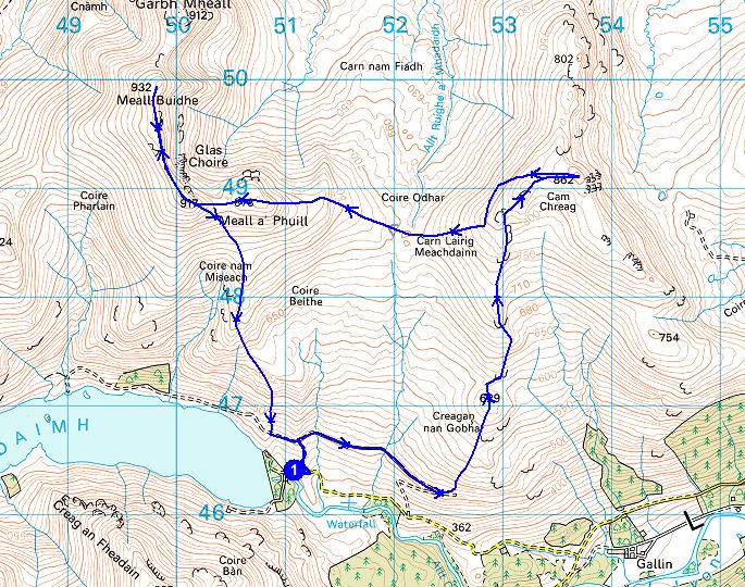
One of the reasons I had chosen these two hills was for the potential of extensive views to the north.  I was not disappointed with Cam Chreag which overlooks Loch Rannoch.  With the summit to myself I sat in the sun and took it all in, a lack of urgency to get moving again.  With conditions so clear I fired off lots of photographs.

P1050495

P1050493

P1050494

P1050499

P1050501

I realised that there was still a lot of ground to cover and that an expansive but hopefully dry bog had to be crossed.  I reluctantly got moving again, Meall Buidhe filling the horizon as I headed west.

P1050504

The going between the two peaks was rough but thankfully dry.  A steep pull up towards the cairn on Meall a’ Phuill and I was on the expansive plateau.  The summit ridge arcs around Glas Choire giving the best walking of the day.

P1050510

The summit cairn is located at the northern edge of the ridge and the views are exceptionally far-reaching.  What caught my eye was Rannoch moor laid out like a map beneath my feet, loch Laidon snaking into the heart of the moor.  Behind it the Mamores and Grey Corries looked small and benign under the blue summer sky.  It’s amazing how perspective can change according to the weather.  Once again I was reluctant to leave the summit and was happy to sit in the sun, being cooled by the breeze.  I would have been very happy to stay up there all night and roll out a sleeping bag as the sun slipped below the horizon.

P1050511

P1050514

I finally tore myself away and headed south down the eroded peaty baggers path.  In places in it is ill-defined as people take different routes through the boggy bits.  Stuchd an Lochain across the glen looked tempting but I was aware that sunset was only a couple of hours away.

Before reaching the van I did a long detour to top up my water bottles for the night.

P1050519

The Bongo was the only vehicle left at the parking area when I finally returned and I had another peaceful and comfortable evening and night.

P1050520

P1050521

I sat and planned a short route for the following day, something quick before the long drive home.  However before sunset the clouds had once again settled on the hill tops and stubbornly refused to shift the following morning.  The drive home was indeed long and incredibly boring once on the motorway, the penalty to pay for a cracking few days in the Highlands.

August 19, 2013

King of the Moelwyns

by backpackingbongos

P1050548

Reuben on the summit of Moel Meirch.

August 12, 2013

The Tarmachan ridge by the back door

by backpackingbongos

It was early evening as I drove past Lochan na Lairige after a day on Ben Lawers.  Even with the sun making slow progress towards the horizon the van was like a furnace.  I was certainly being given a gift by the Scottish weather gods.

Close to a small roadside hut there is a parking area for a couple of vehicles.  With the roof of the bongo up and just a fine mesh to fend off any marauding midges I enjoyed a cooling breeze as I cooked dinner.  I find it strange that after a hot day in the hills the wind picks up around dusk before dropping completely after dark.  This happened that night.

After dinner I loitered around the van with a coffee in hand, eyeing up the Tarmachan ridge to the south.  My plan for the following day was to pick a route around Coire Riadhailt.  The fact that I could not find any reference to it in guidebooks would guarantee a bit of solitude.

P1050448

10 kilometres with 760 metres ascent

The Tarmachan ridge

One of the joys of using a camper van in the summer is that it is much cooler than a tent.  I can also black out the windows which means sleep is not interrupted by a ridiculously early dawn.  I think that’s the reason why I did not wake up until 9.00am, unthinkable in a tent.  It was already hot outside as I sat on the step and ate my breakfast under a cloudless sky.  I traced my planned route around the Coire, marvelling at just how green the mountains were looking.

P1050449

I made my lunch , packed my sack and headed off towards the river that runs through Coire Riadhailt.  I filtered a couple of litres as it was running a little warm and sluggish, hopefully enough to keep me going for the day.  Across the footbridge I headed up rough trackless slopes.  The ground was surprisingly dry underfoot but it was clear that it would usually be a boggy slog.

P1050450

Once on the wide grassy ridge I lounged against a boulder, the short climb in the heat had knackered me out.  A couple and their energetic springer spaniels soon passed by, they had been gaining ground shortly after I left the van.  I was content to just sit and enjoy the breeze for half hour, I was in no hurry with the long hours of daylight.

Back on my feet, as height was gained the vegetation became easier, soon turning to short-cropped springy turf.

P1050455

P1050457

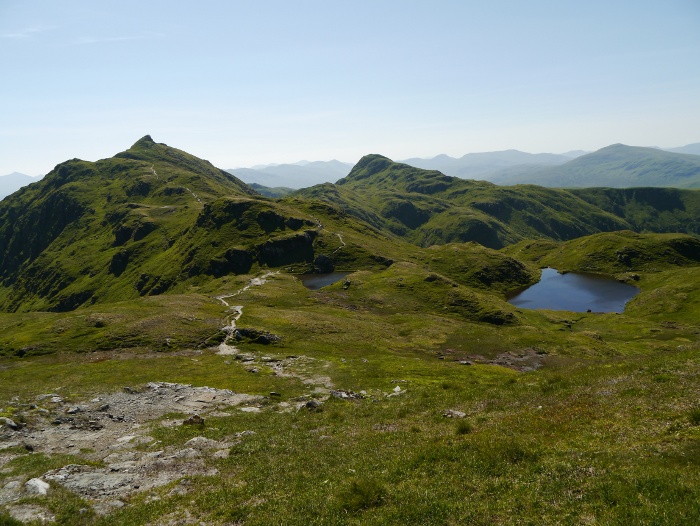
As I approached the Tarmachan ridge, Meall Garbh began to loom ahead, its actual summit a small rocky pimple as seen in the photos below.  I stood for while and watched a few people progress along the ridge and onto the summit.  This gave a sense of scale which is impossible to capture in a photograph.  I could also make out the rocky scramble across its flanks, visible as a faint line to the right of the second photograph below.

P1050460

P1050464

I hit the ridge just to the east of Beinn nan Eachan where I picked up a good path that led me over a small un-named summit.  At the col below Meall Garbh I looked up towards the rocky scramble half way up its slopes.  I picked out what looked to be the best line and then started up the steep path.  It turned out that the scramble was not too bad to be honest and it only lasted a couple of minutes.  I would probably give it a wide berth in icy conditions though.  At the top I had a good view back towards Beinn nan Eachan.

P1050467

The ridge to Meall Garbh is about as good as they come and sadly very short-lived.  Nice and narrow and without any scrambling I would be happy for it to go on for miles.

P1050468

P1050469

P1050474

I was soon at the tiny little summit where I spent over an hour sitting, eating, drinking and generally enjoying the fabulous airy position.  Good company was provided by a couple and their dog Rory.  They were heading west so I hope the dog got down the scrambly bit ok.  As much as I would have liked to sit there all day I was running out of water and it was hot.  The route to Meall nan Tarmachan was clear and obvious.

P1050475

I was tempted to strip off and have a swim in the lochans half way but a group was having their lunch there.  Climbing up the lower slopes of Meall nan Tarmachan I got a good view of Meall Garbh’s pointy little summit.

P1050476

I was keen to drop down to the glen and get some water so I did not stop very long on the summit of the only Munro for the day.  I had noticed some crags along the north-east ridge, so to avoid them I headed north and contoured round.

P1050477

P1050478

The stream that I followed down into Coire Riadhailt was bone dry until a few metres before it joined the main river.  Even that was running very low.  I came across a small concrete dam that was diverting water into a tunnel underground.  The water was waist deep there and I wasted no time in completely stripping off and submerging myself in the icy water.  Once past the initial shock it was rather pleasant in the peaty water.  I did not have a towel with me so after getting out sat on a rock and let the strong sun dry me.  Fully dressed it was an easy walk along a grassy track back to the camper van.

August 4, 2013

Beach

by backpackingbongos

Nottingham is about as far away from the sea as it is possible to get in the UK.  So far in fact that every summer the City Council deems it necessary to make one in the market square.

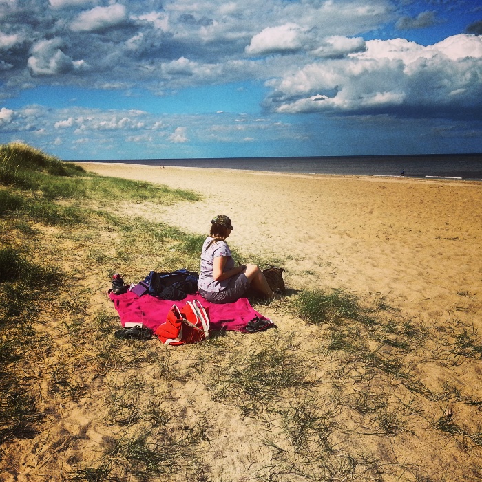
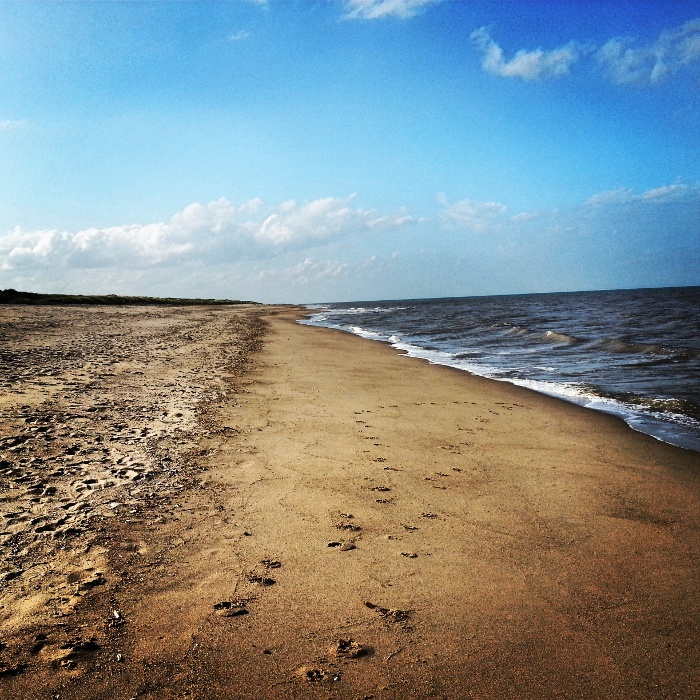
Our nearest area of real sand and salty water is to the east in Lincolnshire.  In over twenty years of living in Nottingham I have never once headed out that way.  I have always thought that the Lincolnshire coast = Skegness, thankfully there is more to it than that.  Ten miles to the north is the small village of Anderby Creek.  Dunes, a clean sandy beach and huge skies over a contour free landscape.

IMG_20130803_173229

IMG_20130804_154716

IMG_20130804_161041

IMG_20130804_160907

IMG_20130804_161358 IMG_20130804_161607

IMG_20130804_162159

IMG_20130804_162011