


The Arctic trail starts at Kautokeino in the far north of Norway and heads south for approximately 800 kilometres. It crosses into Finland and Sweden, finishing either in Kvikkjokk (Sweden) or Sulitjelma (Norway). To confuse things the trail has a different name in each of the countries through which it passes. In Norway it is called the Nordkalottruta, in Finland the Kalottireitti, and in Sweden the Nordkalottleden. In English it is simply called the Arctic Trail as the entire 800 kilometres are above of the Arctic Circle. Not to be confused with the Arctic Circle Trail, which is in Greenland!
Part one can be read here.
Part two can be read here.
Part three can be read here.
It was a blessed relief at dawn to escape the claustrophobic confines of the hut. It had been a painful and uncomfortable night, the room hot and stuffy. The rain of the previous day had blown through and it was good to watch the hut recede into the distance.

The Norwegian / Finnish border was a relaxed affair, a large cairn painted yellow and adorned with a reindeer antler. I had no goods to declare so was able to cross unhindered.

A couple of kilometres past the border and the trail passes the wilderness hut at Kopmajoki. In Finland they have a network of wilderness huts which are free to use, more information can be found here.
The hut was extremely homely and I immediately started wishing that I had stayed there the previous night. It had bunks for six people, a gas stove and utensils for cooking, plus a wood burning stove. Outside was a wood store that was filled to the brim with chopped birch wood, and an enclosed privy nearby. The log book indicated that no one had stayed the previous night. The hut itself was absolutely spotless with not a scrap of litter or even any dust on the floor.
I was soon joined by Thomas with whom I had shared the hut the previous night. As the trail that day would go over a 930 metres pass we decided that we would team up to cross it.

The main difference between hiking the Arctic Trail in Norway and Finland are the trail markers. In Norway I was always on the lookout for a painted red T either on rocks or a cairn. In Finland the trail is marked by a short wooden post about thirty centimetres high with a yellow top. I found the Finnish version less visually obtrusive, which really translates as harder to spot!

As we started the long climb up the pass our conversation turned to pack weight, as Thomas was clearly struggling with his. It turned out that he had started his trek with it weighing about 40kg, a weight that I would struggle to lift let alone carry across rough terrain. Much of that weight appeared to be camera gear, including several lenses. My pack at the start had been around 20kg, probably at my limit these days and relatively light considering I had supplies for twelve days.

The trail crossed the wide Goapmajohka and I did a really stupid thing. I focused on keeping my feet dry instead of just wading across. Whilst boulder hopping I lost my footing and fell forwards, straight into the river. Thankfully I went down onto my knees so I remained dry above the waist, however I was soaked from my undies downwards. Thomas was ahead so I avoided the humiliation of my lack of grace being witnessed. I removed my waterproof trousers in the hope that I would slowly drip-dry, even though there was a fine drizzle.
The path was soon lost in a tangle of boulders and the mist came down as we approached the top of the pass. One of us would stand still whilst the other looked for the next marker, this was repeated for what felt like hours. If we weren’t crossing slippery boulders we were standing ankle-deep in water. It was a relief to cross the highest point and squelch down to the next wilderness hut located next to the large lake called Pihtsusjarvi.
The verandah was full of huge rucksacks but there was no one in the hut itself. I peeled off my sopping wet boots and socks and set about making a hot drink and cooked noodles for lunch. It was good to air my feet, even though I knew I would have to put the same soaking items back on again.
As we were about to set off, the owners of some of the rucksacks appeared. They had been up to the summit of Halti, the highest point in Finland, a goal for many Finnish people. The highest point in Finland is at 1,324 metres whilst the actual summit is a kilometre to the north in Norway at 1,365 metres. There had been talk a couple of years ago about Norway gifting the summit to Finland, however it never came to pass. Due to the popularity of the hike the previously empty trail soon became much busier on the way to Kilpisjärvi.


A river flows wide and strong from the lake, becoming an impressive waterfall at Pihtsusköngäs. The power and noise was incredible and we stood mesmerised at the top for a while, becoming soaked by the spray. It’s worth taking a small detour from the main path to get a proper look.


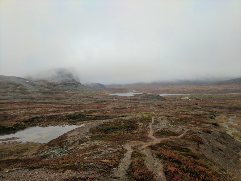
The cloud was slowly lifting again, giving us a good view of the surrounding mountains. This part of Finland is surprisingly rugged.


With much more foot traffic on the trail it became easier to follow, although still exceptionally rough and bouldery. The cumulative effect on my boots was that they looked like the top layer of leather had been sandpapered away.
As the afternoon wore on finding a decent pitch began to look increasingly unlikely. The ground was either solid rock or prickly tent killing vegetation. In the end we found a spot above the river and got the tents up whilst it was still dry. I wandered around for a while waiting for it to air as it was still soaked from being flooded out a couple of days before. It really was a cracking location, especially with the autumn colours which had burst into life.


It rained all night, leaving a residue of low cloud and drizzle the following morning. There was a softness to the light that somehow accentuated the colours of the vegetation and the lichen on the rocks. Everything was slick under foot and we had to shuffle across areas of board walks over marshy areas and impenetrable boulder fields.


The verandah of the locked wilderness hut at Meekonjarvi provided some shelter from the weather whilst we snacked. We could not be bothered with the half mile detour to the open hut. Often the Finnish wilderness huts have an open section and a locked reservable section. In busy areas if you want to be sure of a bed you can reserve in advance for a small fee and pick up the key. Apart from that the facilities look to be the same.
Once again we climbed towards another high pass, this time through a wide valley. To start with there were excellent views but we soon found ourselves swallowed by the mist.

The wilderness hut at Kuonjarjoki loomed out of the clouds just in time for lunch. A pleasant half hour was spent there in the company of some young Finnish men, who patiently answered all my questions about their country. How they managed to remain so clean and well presented after a few days in the mountains amazed me. I was filthy by this stage and was very aware of my unwashed clothes and body in the warmth of the hut.
Thomas decided that he had had enough for the day and wanted to stay in the hut. I was keen to press on so that I could reach the luxury of my booked accommodation as early as possible the following afternoon.
Sadly there were no views from the 950 metre high pass, just more boulders looming out of the mist. It was whilst descending that my mobile suddenly pinged into life, informing me that I had unknowingly been involved in a spot of drama the previous couple of days.
Apparently the two messages I had sent from the hut after injuring my arm had not gone through. My wife, and friends Chrissie and Geoff had been tracking me on Social Hiking via my Spot3 device. When I had reached that hut in Norway at 10.30am I sent two messages and then did not move until early the next day. Because those messages were never received all they knew was that I had stopped moving for some unknown reason. By early evening they started to properly worry and decided to call the Police. Interpol and the Norwegian Police were informed after my wife had lots of fun and games being passed on the phone between various people who were unsure what to do. She informed the Police the following day that I had started moving again, but it appears that no action had been taken anyway!
The moral of the story is that you really should not rely on tracker devices to keep you safe. They are simply an additional tool. Funnily enough the time when I was being reported as missing was when I was in pure agony with my arm. I really would have welcomed a rescue at that point!
I pitched that night just off the trail on the shores of a high lake. The temperature really dropped and there was a damp chill in the air. Mist covered the surrounding hills, sometimes drifting just a few metres above the water. It was an atmospheric place to spend the last night on the trail. A few people passed me during the evening heading for the wilderness hut at Saarijärvi.

The trail the following day continued to be tricky underfoot, constant boulders meant that it was hard to really stride out. As I once again crossed the border into Norway and then back into Finland I could almost smell civilisation. I passed a few day hikers, the first I had seen on the entire trip, their scent of soap and detergent strong after so many days in the wilds.


As the trail descended I was once again in the birch forests which were ablaze with colour. Part of me really wanted to spend time and savour the last few kilometres, whilst the other part was keen for a shower, fresh food and a comfy bed.


I had splashed out in advance and booked an apartment in kilpisjärvi for a couple of nights. I apologised for my smell when I entered the homely reception area. The owner said that it was normal for people in the area to smell like ‘nature’. I was soon sat on the balcony with a pizza and cold beer, both pleased and relieved to have completed one of my toughest treks yet. In a couple of years I plan to return and continue on down the Arctic Trail.
The paper map that I used on this segment is the 1:50,000 Halti / Kilpisjärvi by Karttakeskus. It’s an excellent map and nearly as good as Ordnance Survey in detail. A step up from the Norwegian maps used on previous segments.
Whilst hiking I shared my route live on Social Hiking. That route can be found here and viewable on Google maps.
