Zero day four – Buena Vista
Out of all the towns that I visited on the Colorado Trail I think that Buena Vista was my favourite. The main reason being its size and the accessibility of its services. I had pre-booked a room via Airbnb whilst on the trail (its worth having the app on your phone whilst doing a thru hike). The owners Grace and Jan are slightly bonkers but in a good way. The house is decked out in full on American Victoriana and I kept expecting a line of lace clad women to jump out of the wardrobe to do the can-can.
Everything in Buena Vista is within walking distance and during the two nights I was there I made a couple of visits to the House Rock Kitchen for burgers, and the Evergreen Cafe for breakfast. A supermarket is within walking distance and there is a small but well stocked outdoor store (expensive!). What more does a thru hiker need?
Remember David who gave me a lift to the trailhead and appeared at camp just after mile 100 to bring me brownies? He was passing close to Buena Vista so stopped to bring me a bag of homemade cookies! David has section hiked the CT so a while was spent pouring over maps with a few tips passed on. Thanks David!
Days 18 to 20
Colorado Trail segments 13 & 14
Lowest altitude – 8,194 feet Highest altitude – 10,003 feet
Section distance – 36.6 miles Cumulative distance – 252.5 miles
Section ascent – 5,844 feet Cumulative ascent – 47,099 feet
Grace kindly gave me a lift back up to the trailhead and decided to walk with me for half an hour. I’m embarrassed to say that it took me a while to locate the trail on the other side of the road. I initially led us in completely the wrong direction. We got speaking to a man who was camping by the creek for a few days. Bears had been spotted in the area and he showed us the remains of a dog bowl that he had accidentally left out overnight. The bears had given it a good chew.
It took a bit of searching to eventually find the elusive trail marker, although paying more attention to my map would have helped. It was great to have the company of Grace and her little dog for a mile or so. Although she has lived in the area for a while she had not explored this section of trail before, so she left with plans to return with her husband.
Further along the trail I found myself catching up to a long line of older female hikers. I made the mistake of not making my presence known until the very last minute, which nearly resulted in me being attacked by the hiking pole brandished by the woman at the back. I had done the hiker equivalent of running up behind someone and going ‘booo’.
Unfortunately the weather soon started to turn for the worst with dark clouds building and rumbles of thunder. It was about to become a wet and stormy couple of days.
The storm soon hit so I was thankful to be in the shelter of the trees. The storm passed but left in its wake a legacy of heavy persistent rain which soon overwhelmed my waterproofs. I quickly got fed up and decided on an early camp near Maxwell Creek. If I had of continued it would have been at least four miles to the next water source, despite the large volumes of water falling from the sky.
I managed to find a sheltered pitch some distance from the main camping area and away from the trail. I just about managed to wedge my tent between the trees, a bed of pine needles adding some cushioning. I passed the afternoon reading and eating, later listening to a pair of hikers pitching their shelters nearby. It was not the sort of weather in which to go outside and say hello.
It rained through the night leaving the forest damp and silent in the morning, an atmospheric mist rising through the trees. I shouted my greetings to the guys in the nearby very badly pitched tents as I passed. They had obviously spent a lot of money purchasing the lightest Cuben Fibre contraptions but had not yet mastered the dark art of keeping them upright.
The views were restricted that morning but the damp forest made me feel a bit closer to home.
Unfortunately there is a long road walking section to Mount Princeton hot springs and beyond. At one point the resort is just below you but the road takes a snaking route in the opposite direction, eventually winding its way down the hill.
It may have been the weather but I found the resort to be a bit of a soulless place, clusters of buildings and pools huddled under the cold grey sky. I found the store, purchased an armful of unhealthy snacks, stuffed my face and then went back for round two. You could easily do a resupply here for a couple of days on the trail, but be warned it’s not cheap.
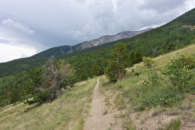
There was another two and a half miles of road walking before I could escape back into the hills at the Chalk Creek Trailhead. As I climbed the clouds were gathering once more, the familiar sound of thunder in the distance.
Once across Chalk Creek there would not be any water for nearly seven miles, this meant that I had to continue whether I wanted to or not so as to avoid a dry camp. There were a couple of moments when I really did not want to continue, I wanted to be safe and sound in a solid building so as to avoid the risk of being zapped by lightning. There was one humdinger of a storm where the hail was so heavy it hurt, I took shelter in the trees and watched natures fury around me. The ground was white by the time it had finished.
In Colorado storms can quickly turn to sunshine and it was soon summer again.
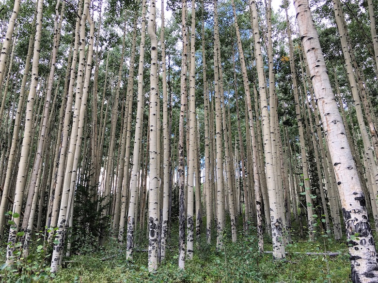
There are a lot of trees in the first half of the Colorado Trail with frequent feelings of Déjà vu. One thing that I could never get enough of though were the Aspen groves. Some of these were magical places with a stillness on the forest floor whilst the wind shook and whispered through the canopy above.
I like to arrive at trail towns during the early afternoon so as to maximise the time I spend lazing around. On the final morning of this section I was up early to complete the 14 miles by a reasonable time. After a couple of days of heavy rain it was a morale boost to spend the morning under sunny skies.
After descending to and crossing the North Fork Arkansas river the weather started to turn for the last climb of the day. I began to get nervous as it looked like it had the potential to be a really nasty one. The sky went black, the temperature plummeted and the wind picked up. It was at this moment that the trail passed right under a large metal pylon, its power line marching its way across the hills. I crossed open ground as quickly as possible, pulled on my waterproofs and legged it towards US Highway 50.
Just as I was about to reach Highway 50 I was caught up by Brenden and Skylar, who I had not seen since Buena Vista. As I was solo I was given first dibs at trying to thumb a lift into Salida, if there was room for three then we would all jump in. In the end I was picked up by a young man in a flash car who was a bit twitchy about having three smelly hikers for company. It was my only uncomfortable ride and I think that he may have been a bit stoned by the way he failed to stay on his side of the road. He dropped me off about five miles from town where I stuck out my thumb once again. Soon afterwards a pick-up with Brenden and Skykar on board stopped and I travelled into Salida on the open back. Thankfully the storm never caught me in the end, the wall of black remained on the horizon.
Zero day five – Salida
Salida is another pleasant town to spend some time in whilst on the Colorado Trail. It’s a bit more spread out than Buena Vista, but everything is still within walking distance. I had managed to bag a small reasonably priced apartment through Airbnb, complete with washer and dryer. Although I had only walked 37 miles from Buena Vista I still treated myself to two nights in town. The next segment to Lake City would be the longest, my pack the heaviest with eight days supplies. Whilst in Salida I managed to hook up via Facebook with Chuck Deveney, who offered me a ride back to the Trailhead. Chuck is the main Trail Angel in town and a thoroughly decent bloke. He picked me up outside the Patio Pancake Place after I had filled my belly with a massive breakfast (highly recommended if staying in Salida). It was an appreciative thru hiker who got out of his vehicle on a bright sunny morning and set out on the section of trail that unfortunately nearly broke me.


