Archive for July, 2015

July 25, 2015

Across the Peaks – Ashbourne to Hayfield

by backpackingbongos

I have always fancied walking across the Peak District from south to north taking in the best parts of the National Park. Before setting off on the TGO Challenge I planned to do just that as a way to get fit. However when I actually sat down with maps to plan a route it became apparent that it was too far for a three day weekend. The original idea was to go from Ashbourne to Marsden, but in the end Ashbourne to Hayfield was much more manageable at 63 kilometres and 1700 metres ascent. The route went through a great variety of landscapes, from deep dales to high moorland. It’s good fun linking areas that you know well from day walks into a long linear route. You get to see them from a different perspective, a small part of a bigger picture.

Wild camping is difficult in the Peaks, especially in the south. Rather than staying in large commercial sites I booked two Certified Locations that are affiliated to the Camping and Caravan Club. Chrissie joined me for the weekend and she helped with the travel logistics. Her husband Geoff picked me up from Monyash where I left the car and dropped us both in Ashbourne. Chrissie lives in Hayfield so after finishing she dropped me off in Monyash. It all worked rather well.

Anyway, rather than a blow by blow account of the walk, here are a few photos and comments.

P1090173

Thorpe Cloud, a mini mountain that guards the entrance to Dove Dale.


P1090177

Lin Dale, leading towards the famous stepping stones in Dove Dale.


P1090178

Looking down at Dove Holes, Dove Dale.


P1090180

Early spring in Upper Dove Dale.


P1090181

Wolfscote Dale.


P1090182

Campsite at Pilsbury Lodge. A bit overpriced at £10 each and spoiled by the hyperactive screaming children who were running round until 10.30pm.


P1090184

Crossing the Limestone plateau just past the Bull-i’-th’-Thorn pub. 


P1090186

Descending into Deep Dale.


P1090188

Descending into Litton Dale.


P1090189

Looking towards Tideswell Dale.


P1090191

Millers Dale from the Monsal Trail.


P1090194

The lower reaches of Monks Dale before it gets tricky.


P1090196

The wooded section of Monks Dale is a chaos of slippery limestone rocks, tree roots, mud and vegetation. We were relieved to leave that behind and follow a simple path through the woods.


P1090199

A lovely little campsite in Peak Forest that is basically someones back garden. A bargain at £8 between us.


P1090201

Climbing out of Peak Forest.


P1090204

On the limestone plateau above Conies Dale.


P1090208

Rushup edge looking towards Mam Tor and loads of paragliders. Mam Tor and its surroundings were swamped with people on a fine Sunday. Rushup edge was all but deserted.


P1090209

Looking down into the Edale valley with Kinder Scout on the skyline.


P1090214

Crossing Moorland en-route to Brown Knoll.


P1090216

Looking down to the upper River Sett.


P1090217

South Head.

Three days of glorious spring sunshine and with good company from Chrissie. What the photos don’t show are the numerous stops for ice cream, cafe’s and a pub. Sometimes it is good to backpack away from wild and remote mountains.

You can read Chrissie’s version of the trip here.

July 19, 2015

Stronelairg – 5 snowy days in the Monadhliath pt2

by backpackingbongos

Part one of this trip report was published a few months ago, unfortunately other trips got in the way and I never got round to writing part two. So cast your minds back to Easter this year……….

You can read part one here.

The contrast with the murk the day before could not be greater. The mist, low cloud and poor visibility had been replaced by blue skies and crisp visibility. The air was still and despite snow still laying on the ground it felt warm.

The upper reaches of Glen Tarff really is a gem, a place where no one really bothers to venture. I picked up the old stalkers path and climbed my way back onto the Monadhliath plateau, enjoying the retrospective views down the glen to distant snow-capped mountains.

P1090123

P1090128

The plateau was reached just south of the dam for the newly built reservoir. The sense of space on that clear spring morning was exhilarating. Sometimes you don’t need high craggy mountains, the empty rolling moors often make me feel just as happy to be out.

P1090131

P1090134

I was heading for the summit of the Corbett Gairbeinn. Normally this would be a straightforward affair of walking across the moors and climbing onto its long summit ridge. However with deep and rapidly melting snow on the ground it was not quite that easy. The various watercourses were covered in unstable snow bridges, banks ready to collapse either side. I spent a while linking up patches of snow free ground, often making detours when the snow became too deep and soft.

P1090139

The going was easier on the higher and steeper slopes, the snow still having a bit of bite which meant that I could kick steps up. With a heavy winter pack, warm sun and no wind I quickly felt exhausted. The high snow-covered plateau however was spellbinding and I did not need much excuse to just stand and drink it all in. I was sad with the knowledge that soon the whole area will be covered in wide roads and wind turbines.

P1090141

P1090142

The ridge of Gairbeinn was snow free but the east side was heavily corniced. There had recently been an avalanche which is visible in the third photo below. Some of the blocks of snow were the size of a chest freezer, not something that you would want to get caught up in.

P1090145

P1090147

P1090148

I lingered at the summit for a long time, out of the wind the sun felt warm and the surroundings were majestic. Across the infant Spey the Creag Meagaidh hills towered high and snowy. Much of the high plateau of the Monadhliath was still draped in virgin white, so I decided against a planned long walk across the summit of the Corrieyairack to bag some more Corbetts. Even though it was only early afternoon and I had walked only a few kilometres I decided that I would look for a nearby high level pitch and just enjoy my surroundings.

P1090150

P1090152

I backtracked along the ridge and then descended to the east to a good spot on the 780 metre contour. I pitched the Trailstar and spent a lazy afternoon and evening reading, brewing and eating. Taking time to walk around various vantage points above camp. The air soon became cold and crisp, the hills glowing in the setting sun.

P1090156

P1090158

P1090160

P1090164

It was only a short walk back to the car the following morning so I decided on a small detour to climb Creag Mhor. It’s a small hill that does not feature on any lists but it was worth the effort for the views along the upper Spey and back to the plateau from which I had come.

P1090168

P1090169

The often grassy banks of the Allt Gilbe eased progress back to Garva bridge. I passed a family picnicking next to the bridge over the Allt Coire Lain Oig, the first people who I had seen in five days. I could not think of a finer place in which to spend a busy Easter weekend than the lonely underrated Monadhliath.

P1090171

July 16, 2015

TGO Challenge 2015 – Days 12 to 14

by backpackingbongos

Days 1 to 3 can be found here.

Days 4 to 6 can be found here.

Days 7 to 9 can be found here.

Days 10 & 11 can be found here.


Day 12 – 14 kilometres with 220 metres ascent

Day 12

(Click map to enlarge)

It was the coldest night of the Challenge. I woke at first light and tried to unzip the fly which was a solid sheet of ice. The rain the previous evening had frozen and I was treated to an icy shower as I brushed against the Scarp. I went back to sleep for a few hours until the sun had risen over the hills and warmth filled my tent.

The Water of Unich was followed downstream for a bit before I crossed it and picked up a track that led up and over Carn Lick (I couldn’t find a cairn to lick).

P1090406

P1090407

The Shank of Inchgrundle is a great name for a very scenic ridge walk down towards Loch lee. The views along the Loch and up the Water of Lee to Mount Keen were splendid. The following two days would be across farmed glen, intensively managed grouse moor and country lanes towards the coast. I took the opportunity to savour the hills whilst I could.

P1090410

P1090411

P1090416

The walk along the Loch is via a well used landrover track. I stopped often and sat on various rocks in the sun, avoiding leaving the hills behind.

P1090418

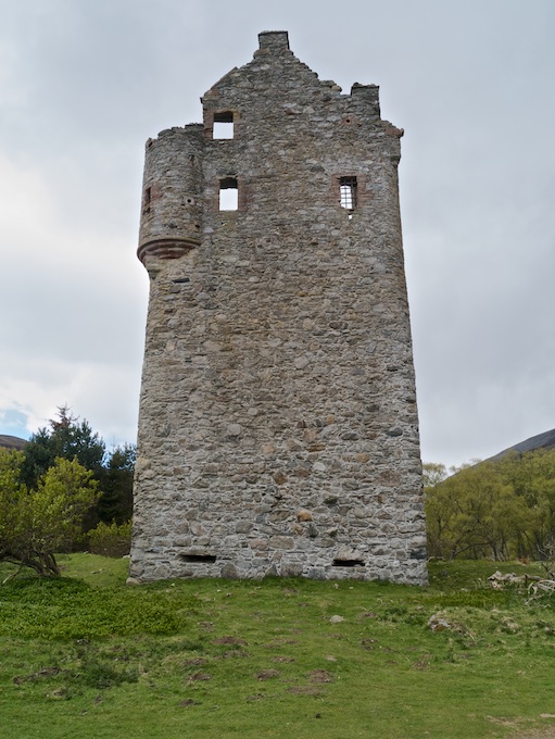
Just past the castle and at the beginning of the public road I spotted Louise approaching from Glen Mark. After a couple of days on my own it was great to receive a warm hug and see a smiling face and we talked of our adventures as we walked together to Tarfside. The hill path that skirts to the north of the Hill of Rowan is a much better alternative to walking the road, although I have never been tempted to climb the small hill with the big monument.

We both made a beeline straight for St Drostans Hostel, an oasis of Challenger hospitality along with food and drink. The big kitchen table was crowded with other Challengers and it was great to catch up with others after a crossing mostly undertaken in solitude. I was offered a bed for the night in the hostel and jumped at the chance of a room all to myself. Louise was offered a room with a young handsome Canadian chap as they were mistaken as a couple (I think Louise was flattered). She then managed to draw the attention of the obligatory weird and sexist Challenger………

I sorted out my room and then sat in the lounge for a while to drink beer and be sociable with various folk who I knew through blogs and Twitter, but had not met in real life. Chrissie was on a grand tour of Scotland and had come to Tarfside to meet me and sample the social side of the Challenge. I wandered with Robin down to her van which was parked up next to the village green where we passed another sociable couple of hours drinking coffee and eating cake. I had booked dinner at the hostel so walked back to fill myself with Carbs. A night in the Mason’s arms with plenty of beer saw me heading back to my bed in the dark a little ‘dehydrated’.


Day 13 – 22 kilometres with 520 metres ascent

Day 13

(Click map to enlarge)

A mixture of alcohol coursing through my veins, a hot room and numerous people who can’t close a door without slamming it meant that I slept badly. Coffee and an egg cob settled my grumbling stomach and I headed off to walk the road to the Retreat with Louise. A mile later and we were stopping for breakfast number two before continuing along the road to Edzell. We said our farewells after a few more miles as Louise crossed the river to walk along the south bank of the Esk. I continued a bit further before taking the track that heads up to the moorland summit of Craigancash.

On the horizon above I could make out Alan Sloman and Phil and I did my best to try to catch them up. The views to the west were lovely but the hills around me were covered in tracks leading in all directions, the heather scarred with a patchwork of Muirburn. This part of Scotland is an intensively farmed monoculture used for the raising and shooting of grouse.

P1090420

On the climb I was aware of a figure watching me, the strange thing being that it did not move at all. This became more unnerving as I got closer. A man in a blue boiler suit and red hat remained motionless in front of me, it was only at the last moment that I realised that it was a mannequin. It was pretty obvious but I really had not expected to see a shop dummy with a wooden pole shoved up its trouser leg on a Scottish hillside. The fact that its mouth was taped made it all the more creepy.

P1090424

P1090426

I found Alan and Phil just finishing their lunch as I stopped for mine, so I was left alone to watch them grope another dummy of non specific gender that was hanging out further up the track. The coastal plains were far below my feet, green and yellow fields stretching to the sea which still looked a long way away. It was good to see it glinting on the horizon though, I was nearly at journey’s end.

Passing the dummy I could not help noticing that it was not suitably dressed for the hills, remember folks cotton kills.

P1090427

Progress was halted by a tall deer fence which fortunately was not electrified. It was a bit of a precarious climb to get over it though. It would be pretty much impossible with a dog, so perhaps not the best area to return with Reuben.

I caught up with Alan and Phil in a brand new shooting hut complete with comfy chairs and a functioning gas cooker. I soon left them to it as I was keen to get into Fettercairn and the hotel that I had booked for the night. It was a long descent down Herd Hill and through the Wood of Mon Duff. The final walk along tarmac left me feeling foot sore.

The Ramsey Arms was a real gem, by far the best place I have stayed in in Scotland. Friendly staff, bags of character and comfy rooms. Chrissie had motored over in the afternoon and parked up the van in the village. I was too tired to be sociable so headed straight to my room for a well needed shower and to rinse my filthy socks. It was a sociable evening in the bar though with Chrissie, Alan, Phil and another couple of Challengers whose names I have already forgotten. As well as Guinness they served up huge portions of excellent food. I wholly recommend the Ramsey Arms for food and lodgings and a final nights treat on the TGO Challenge.


Day 14 – 23 kilometres with 180 metres ascent

Day 14

(Click map to enlarge)

The last day of walking was not one I had been particularly looking forward to. Twenty three kilometres along tarmac is not really my idea of fun. After a decent breakfast I went and said good morning to Chrissie and the brown Lab Tilly and arranged for the van to become a mobile tea van around lunch time.

I headed off under leaden skies, a light rain falling for the long trudge to the east coast. Initially there was a nice path through beech trees but this soon deserted me and it was tarmac all the way. The crossing of the A90, which is a dual carriageway was a bit hair raising and I was glad to get across in one piece. Chrissie met me just to the north of the Hill of Garvock where I fortified myself with coffee, sandwiches and cookies. The timing was perfect as the rain got heavier whilst I was in the van.

The walk from there into Inverbervie passed without too much excitement, the towering turbines of a wind farm being a bit overwhelming at one point. I could not believe just how noisy they were even from a mile away.

Inverbervie itself is a pleasant place to finish, a functional Scottish seaside town. I met Chrissie and Tilly for a celebratory dip of my toe in the sea. I had decided the day before that I could not face the Challenge meal in Montrose. I really did not fancy camping at the busy Montrose campsite (not particularly pleasant) and all accommodation in the town had been booked up. Instead I secured a cheap room at the Star Inn in Inverbervie which was actually very pleasant and excellent value for money. I met Chrissie that evening at the Bervie Chippy for a celebratory meal. A pleasantly understated way to finish my third TGO Challenge.

P1090430

July 15, 2015

You can find some really weird things on the hills

by backpackingbongos

20150520_131740 (1)

All will be made clearer on my next post.

July 9, 2015

TGO Challenge 2015 – Days 10 and 11

by backpackingbongos

Days 1 to 3 can be found here.

Days 4 to 6 can be found here.

Days 7 to 9 can be found here.


Day 10 – 22.5 kilometres with 880 metres ascent

Day 10

(Click map to enlarge)

Harmonicas should be banned from public spaces unless the user is a trained professional. A merry band of Challengers were enjoying a beer or two right below my room in the Moorfield Hotel. That was ok by me as I knew that would be the case when I booked. I had not taken into account a drunk man with a harmonica though.

The day started off with some very heavy showers as I left Braemar and walked along the road past the golf course. The way to Callater Lodge is straightforward, and I was happy to see what I hoped would be the last of the showers head swiftly east.

P1090350

The hospitality for Challengers at Callater Lodge is legendary. Before I had even managed to remove my pack Bill popped his head out the door and offered me a cup of tea. I entered the warm kitchen full of Challengers swapping tales in front of a roaring fire. I was kindly offered a bed for the night by Bill but I had plans to climb some Munro’s whilst the weather was fine. After half an hour I said my goodbyes and headed up the path at the back of the lodge and bothy.

P1090351

After ten days of bog and moor the path that leads up to and over the shoulder of Carn an t-Sagairt Mor was a thing of beauty. It is brilliantly constructed at an angle that makes the ascent nice and easy. I took my time though, frequently stopping to take in the views which were extensive due to the cold and crisp air.

P1090357

P1090358

P1090362

P1090363

Carn an t-Sagairt Mor was an easy bag, a short stroll off the path. On the way up a passing shower gave me a good battering and I had to bury my face in my hood as protection from the stinging hail. One hefty gust saw my pack cover take off at great speed. It was last seen heading for Lochnagar with great enthusiasm.

P1090364

Some hill days are as close to perfect as it is possible to be. After the rucksack cover blasting shower the weather remained benign for a while and I enjoyed a high level promenade over two more Munros, these being Cairn Bannoch and Broad Cairn. I remained above 900 metres and there was a great feeling of space and solitude up there. I did not see a soul, the hills were all mine. This is perfect hands in pockets yomping country, distance and ascent effortless. In this case a few pictures can say more than words.

P1090366

P1090367

P1090370

P1090372

P1090374

P1090376

P1090383

P1090385

The path down the east of Broad Cairn soon turns into an ugly eroded track, a bit of a disgrace for the Cairngorms National Park. However it was much easier than the extensive boulder field that preceded it. I could see that bad weather was rapidly coming in, a big wall of cloud and grey heading my way. It was time to look for a place to pitch for the night before the forecast wind and rain hit. I spotted a tin hut and a patch of green on the high plateau below me and decided to go and investigate. The hut itself was a midden of animal excrement, whilst outside shit stained toilet paper blew in the wind like soiled streamers.

The weather arrived in a misery of wet. I was high and exposed and indecisive whether or not to drop down to Loch Muick or continue ahead. In the end I decided to try the headwaters of the Black Burn. This initially was a disappointment of rough heather and peaty pools. I was very pleased to find a tent sized patch of flat, reasonably lump free grass. I wasted no time in setting up. Thankfully a window of dry weather that evening gave me an opportunity to dry out some of my kit before the rain returned for the rest of the night.

P1090387

P1090389

(Click map to enlarge)


Day 11 – 12.5 kilometres with 320 metres ascent

Day 11

Waking to a world of grey murk is never conducive to getting out of a warm sleeping bag with much enthusiasm. Especially when that day involves miles of rough ground without a hint of path. In the end the walk across the barren wastes of the catchment area for the Black Burn was not too bad. Years of hiking in the Dark Peak toughen your resolve for this type of walking. Lochnagar remained scowling under a blanket of cloud all day.

P1090394

P1090397

A large cairn on the summit of Ferrowie gave some shelter for a quick snack, the cloud remaining high enough to enable me to plan the ascent of the Lair of Aldararie. There are some great names on the map within this part of the eastern Cairngorms.

P1090398

I was dropping down into the headwaters of the Water of Unich when the temperature suddenly plummeted. It literally fell several degrees in a matter of a couple of minutes. A cold rain started and became heavier before finally turning into large wet snow flakes. This quickly began to settle into a slippery slush, my toes wet and cold within mesh trailshoes. It was an unpleasant walk down by the river, the hills hidden from view under cloud and swirling snow.

I cut a corner off the long twisting glen by climbing and descending along the Burn of Longshank. As soon as the snow stopped it melted away under the strong May sunshine. A reasonable pitch was found alongside a ruin next to the river. Another snow shower blew in whilst I was pitching but quickly passed allowing me to once again dry out my kit before getting comfortable for the night.

Sadly it would be my final camp on this years Challenge. However it was a good one.

P1090402

P1090403