Arncliffe was deserted as I drove through the picturesque village huddled around its green. I parked the car just past the bridge over Cowside Beck where there is space for a couple of vehicles. It was planned to be a sociable weekend in the hills, but as the week progressed people pulled out and I headed out alone. I had even planned to take Reuben but the forecast for the first afternoon was for heavy hail showers and there were dry stone walls to cross on the second. Reuben loves the hills but is a bit of a fair weather camper.
Day 1 – 8.4 miles with 500 metres ascent
A walled track led me away from the village, its surface hidden under water. It was a soggy trudge to the first field where I was nearly swallowed by a cunningly disguised bog. The bog looked like any other patch of cropped grass but it was just a ploy to fill my boots with water and muddy my trousers.
The walk though the fields towards Litton was pleasant in the early afternoon sun. As usual I had underestimated the time it would take to drive to the Dales, I now had less than four hours before the sun started to set. Daylight is in short supply in November.
Litton appeared on the other side of the River Skirfare, huddled below the steep slopes of Middle Moor, two deeply incised side valleys cutting into the hillside above. I followed a walled track, heading further up Littondale.
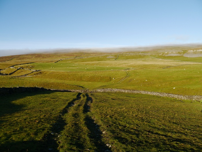
The track soon departed from the right of way and started to climb up the hillside, giving good views back down the Dale. Ahead of me the walled track climbed steeply towards the horizon.
I was passed by a lone man on a scrambler bike, coasting down with his engine off. I’m not sure of what the legality of riding on this track is so waved my hand in a greeting. He ignored me. Throughout the length of the track there was no evidence of any other vehicles having used it, his tyre marks being the only imprints on the softer parts of its surface.
Once height had been gained the going was easy and the view down Pen-y-ghent Gill and across the moors was excellent. As I stopped for a quick snack the clouds started amassing above Pen-y-ghent itself, the threat of rain hanging in the air. For once my decision not to put on the waterproofs paid off and the clouds quickly cleared. The late afternoon sun was beginning to promise a good sunset.
After a quick walk along an unfenced lane I took to the Pennine way as it climbs up and across Fountains Fell. Shortly after leaving the road I passed the only people I had and would see out walking all day. Stopping to chat I was asked where I was heading, seeing as it was getting late in the day. Continuing my climb, I got an unusual view of Pen-y-ghent, a hill I am much more used to viewing from the west. Its steep flanks were being highlighted by light and shadow.
After an initial boggy stretch the path up Fountains Fell was a joy to walk. It’s firm underfoot and climbs at a comfortable angle diagonally up the hillside. I imagine that it was originally engineered to service the now disused mines that are located on the summit of the hill. I took my time on this section, enjoying it immensely. I found myself stopping frequently to look behind me and the setting sun slowly changed the surrounding hillsides. A dark bank of cloud over Ingleborough signalling weather that looked like it would be heading my way. It really was one of those half hours that make the effort of getting into the hills worthwhile.
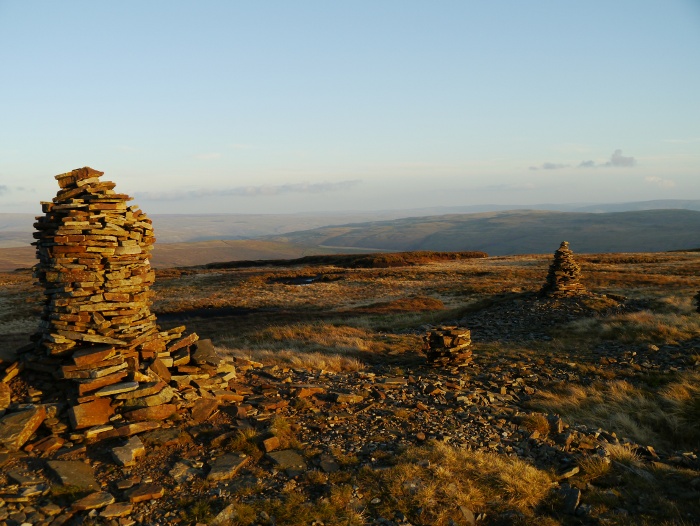
As I crested the steep northern flanks of Fountains Fell I found myself blinded by the low sun, a huge orange ball dipping below the moorland horizon. There were lots of signs warning of deep mine shafts in the area, some of which I had peered down with nervous fascination on a previous visit. I walked over to a fenced off area which was protecting a narrow and very deep shaft. Without the fence I would imagine that it would be difficult to spot it before it was too late. A huddle of cairns invited me over where I enjoyed the last of the sun before it set behind the bulk of the hill.
I had an idea of where I wanted to camp, although I was unsure if it would be suitable for pitching a tent. The Pennine way gave a good firm surface as I descended. I noticed that above me the sky was beginning to quickly cloud over, this sped me up as I was keen to pitch before it started to rain. Just past Tennant Gill I spotted a patch of flattish rough grassland, much more preferable than the surrounding moorland. With the last of the light quickly fading I got my tent up and went to fetch some water from the nearby stream.
I had brought with me my old faithful Voyager tent, something which I have neglected recently due to its weight. Its geodesic design provides loads of room which is perfect for long winter nights. It’s good to be able to sit up without touching the sides and even to be able to cook in the porch with the door almost fully zipped up. I find it a really nice space to spend a long long night in, when you are camping for fifteen hours it can be worthwhile carrying an extra kilo’s worth of shelter.
I was soon unpacked and comfortably ensconced in my tent, the stove on for the first brew of the night. A light rain started to fall, a cosy and comforting sound when you are warm and dry in your tent. This became heavier during the early evening, a change to how the rain was falling on the nylon above indicating that it had turned sleety. During a lull in the rain I got out to wash my only pot so that I could make another hot drink. I had an alarming moment when I turned around to walk back to the tent and it had vanished, swirling mist proving disorienting against the beam of my torch. Dressed in just a pair of leggings and a base layer I would not have lasted very long on the open moor. Thankfully the tent which was only a few metres away reappeared once again.
The evening passed remarkably quickly once I was drawn into the book that I had brought along on my Kindle. It was late by the time I turned off my torch and closed my eyes. I slept well that night.
Day 2 – 12.7 miles with 470 metres ascent
I had set my alarm for 7.00am, time to be up and about for the sunrise at 7.30am. It was an effort to get myself up as I was particularly warm and comfy. With a cup of coffee in my hand I got out of my tent wrapped in a down jacket to witness a splendid sunrise.
I stood around for half an hour watching the light change around me. To the south of Malham Tarn there was a solid wall of cloud which appeared to have stalled in front of the hills. Gradually it rolled like a giant wave over the tarn and drifted up over the limestone plateau above before dispersing. Rye Loaf hill suddenly became an island above the clouds before becoming engulfed once again. Above me wisps of mist were drifting across Fountains fell. Cloud wise there was loads going on, yet I remained under clear skies.
I quickly packed after breakfast and had another cup of coffee before setting off down the Pennine way.
I descended to the road, the Pennine way leading me towards Malham Tarn. Looking back, the summit of Fountains Fell was still flirting with the mist under an unblemished blue sky.
I was walking directly into the low sun, cursing the fact that I had not brought my sunglasses. I usually bring a baseball cap but had replaced it on this trip for my warm mountain cap. It was far too warm that morning and I walked half blinded into the sun, the beginnings of a headache forming. Note to self, sunglasses in the low light of winter are just as important as in mid-summer.
The Pennine way led me on a track around the north of Malham Tarn and through the field centre at Malham Tarn House. I peered through a window to see a lesson taking place and walked though a group of students doing some field work. A rather splendid location to do a course.
I left the Pennine way and took an unmarked track below Great Close Hill which is fringed with a band of low limestone cliffs.
I passed the first hikers of the day on the long drive that leads to Middle House farm. They were walking with a loud radio playing bagpipe music. It was approaching 11am on remembrance Sunday so I could only assume they were listening to the ceremony. Music filled the air as they climbed Great Close Hill, I wondered if they had ever heard of headphones?
Turning onto Mastilles Lane I passed a herd of what I assume were Belted Galloway, calm beasts that hardly batted an eyelid as I walked though them (although I was glad I had not got Reuben with me).
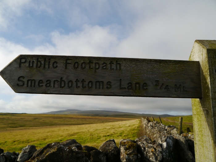
Mastilles Lane goes all the way to Kilnsey in Wharfedale and is thankfully free of traffic these days. It was a pleasant walk though Dales scenery, a footpath sign putting a childish smile on my face.
The lane was deserted apart from a farmer having a cup of tea in his Land Rover, having gathered sheep into a pen. I continued past him for a few hundred metres to a gate that I had planned to use to get onto Access land. It was firmly padlocked. I checked the map again, yep I was heading onto access land. I debated what to do seeing that I was in clear view of the farmer. The gate was the only way through a high dry stone wall that stretches for miles. The only option was to quickly hop over the gate and walk briskly up the hill, not looking back.
My destination was the summit of Proctor High Mark, a limestone summit in a large unfrequented area called the High Marks. The views are extensive from the rather impressive lower cairn. The grassy slope behind it was sheltered from the wind and I took the opportunity to sit down for a while and make coffee and cook lunch. It was rather pleasant in the sun.
The actual summit is marked by a much smaller cairn sitting on an extensive limestone plateau. There is a real feeling of space and I guarantee that you will get the summit to yourself if you venture up there.
My aim was to pick up the Monk’s Road which is a right of way, via another summit called Parson’s Pulpit. The only issue is that the area is criss-crossed by a network of high dry stone walls, most of which are topped with wire. A challenge, even though the area is all open access. Thankfully the first wall had a stile built into it in the form of large cross stones which are invisible until the very last minute. I then skirted a huge bull before cutting back on myself onto a bridleway which took me through another wall. I managed to get onto the summit of Parson’s Pulpit by climbing a further locked gate, chuffed that my route had not involved any risky manoeuvres over large walls.
I then found myself trapped behind a rather tricky obstacle, a high wall which was topped by even higher wobbly fencing. With another farmer out on the fells with his two Border collies I did not want to start attempting to clamber over them. Therefore I walked for a while looking for a gap /gate neither of which were forthcoming. In the end I managed to step over a low fence which was situated above a line of crags. I managed to scramble safely down after letting gravity help my pack descend to the grass below.
Dusk was on its way as I made my way down the Monk’s Road, a great path that contours its way high above Cowside Beck. It was this section that I was looking forward to walking the most. However with daylight quickly fading and tiredness setting in I did not get to savour it. I did however notice some promising wild camping spots next to the river and hidden deep in the valley.
By the time I reached the car in Arncliffe it was properly dark. What surprised me during the two day backpack (with the exception of the area around Malham Tarn), was just how few people I had seen. Once again even Arncliffe appeared deserted.


