Posts tagged ‘Mid-Wales’

May 6, 2016

Escape to the Elenydd

by backpackingbongos

With the Colorado Trail now less than three months away I thought that I should start some training. The idea was for a 51 mile linear walk south to north across the Yorkshire Dales over the May Bank Holiday. Predictably my annual spring cold arrived just in time to scupper the whole thing, along with a rubbish weather forecast for the Dales.

Although I was not well enough to drag my carcass for miles across the moors with a heavy rucksack I was not too ill to have a leisurely explore in the camper van. With it being a spring Bank Holiday I switched on my misanthropic people avoidance radar and set the van on a course for the Elenydd.

Obviously the readers of this blog are hill connoisseurs and know exactly where the Elenydd is located. It’s a huge upland area of Wales that stretches roughly from Pumlumon in the north to Mynydd Epynt in the south. It includes gems such as the Elan valley, a brilliant place to explore. However for this visit I decided to head for the area surrounding Llyn Brianne, north of the town of Llandovery. The Bank Holiday people avoidance plan worked, on the hills over the weekend I passed a total of two couples, both within a minute of leaving the road. The moors themselves were totally deserted, just sheep and very optimistic skylarks. A few phone pictures and words:

IMG_1318

The problem with getting to Wales from the East Midlands is that Birmingham and the West Midlands are in the way. Words such as M6 and M42 fill me with fear and horror. Somehow I avoided the awkward bit and found myself passing Titterstone Clee Hill. Considering that there is a car park near the summit I felt it would be rude not to pay it a visit. I sat in the comfort of the van for a while watching a hail storm slowly progress across the Shropshire Hills. It was a few minutes of violence when it finally hit.

IMG_1325

It’s less than half an hour round trip to the summit itself. There you can have huge views with very little effort. This is made even better when viewed under blue skies whilst a northerly wind leaves pin sharp visibility.

IMG_1326

The view to the east is obscured by a large mast and a selection of giant golf balls, part of a radar station. Add to that extensive quarry workings and it is not the most beautiful of hills. The views are stunning though.

IMG_1334

The Sugar Loaf Halt on the Heart of Wales line is apparently the least used railway station in the UK, with an average of five passengers a month. I was going to use its car park but it turned out that it does not have one. Instead I parked at the start of a forestry track nearby to ascend the 511 metre Garn Wen. Located at the edge of the Elenydd and overlooking the Mynydd Epynt the views encompass rugged moors, forestry, green valleys and pastures. Reuben did his best above to blend into the scenery. Spot the dog?

IMG_1336

One thing that really struck me about this part of Wales is the lack of windfarms. There was not a single one to be seen in any direction, and the views were massive. Dominant on the horizon to the south was the Brecon Beacons National Park. I could clearly see the Black Mountains, the Pen Y Fan hills and the Black Mountain. Their shapes are unmistakable and the rolling foothills led to the sheer sense of scale.

IMG_1354

IMG_1355

IMG_1399

The road around the Llyn Brianne gives a rollercoaster of a drive. High above the reservoir it is single track all the way with many steep sections and hairpin bends. I found a cracking spot to park up for the night, traffic being non-existent after about 6pm. I was joined for a few hours by a couple of local lads in their camper before they eventually headed home. The following morning the birds were up early and singing their hearts out, it felt like spring had sprung, although temperatures were still close to freezing.

IMG_1356

IMG_1400

IMG_1361

I have a feeling that Gopa Uchaf and Garn Gron are not high on many people’s tick lists. They are located on the western edge of the Elenydd, not far from the village of Tregaron. They both give the feeling of standing on the shore of a vast moorland sea, the gentle slopes rising and falling like waves. The moors give the impression of easy walking but they are far from that. If the tussocks don’t twist an ankle, they will wear down your resolve.

IMG_1401

Orange bailing twine reminds me of my childhood in Suffolk where I often found myself lifting bails of straw onto a wobbly wheelbarrow. We always had to earn our pocket-money as kids. Here it was used to tie a slowly rotting gate to a moss and lichen encrusted post. I’m not quite ready to use it as a belt just yet.

IMG_1375

The joy of a campervan is stopping anywhere that takes your fancy and being able to enjoy the hills with some degree of comfort. The road between Tregaron and Abergwesyn is also single track and there are plenty of arrows on the OS map to indicate the steepness. The Devil’s Staircase is impressive with its 1 in 4 gradient and several hairpins. I found a high commanding eyrie for the night and spent the evening with the tailgate open, enjoying the expansive views in the sun. I felt less smug the following morning when the cloud was covering the hills, drizzle being blown on the cold wind.

IMG_1378

The highest point of the Mynydd Epynt is probably the quickest hill bag in the whole of Wales, mostly due to the fact that it is a couple of hundred metres from the road. What makes it tricky though is that it is on an active MOD firing range. After a bit of online research I discovered that there was no firing over the weekend. I made a quick dash for it.

IMG_1381

IMG_1392

The Radnor hills made a good stopover on the way back to Nottingham. To the north of the village of New Radnor they rise to over two thousand feet. However the most shapely of these is the lower Whimble, which apparently used to have access issues. The van was parked for the night in a high forestry car park and Reuben and I had a bimble up Whimble. The wind was blowing and the cloud was covering the higher tops but the view was still spectacular. The path to the top is surprisingly steep.

IMG_1393

The car park was a peaceful place to spend the night, with the exception of the usual late evening and early morning dog walkers.

Mid Wales is a superb place to visit when the more popular hills are going to be busy. Yes there are no rocky ridges and spectacular peaks, however there is a great feeling of wildness and getting away from it all. Even the quiet roads are a pleasure to drive, perfect to explore in a camper van.

May 21, 2012

Pumlumon Fawr – a night on the roof of Mid Wales

by backpackingbongos

As I turned off the mountain road towards the nature reserve at Glaslyn I noticed that the verges surrounding the entrance to the track was full of parked vehicles.  I began to wonder if maybe the car park next to the lake was full, although this would be unlikely in such a remote out of the way spot.  It is just under a mile of a rough pot holed track to the little car park and I received a couple of scowls from walkers as I rattled past them on the track.  As usual the parking area was empty, a delightfully remote spot to start a walk and with the added bonus of being at 480 metres above sea level.

Day 1 – 7.5 miles with 505 metres ascent

Reuben was happy to start the walk unencumbered by a lead as there were no sheep about.  A firm track took us over a low ridge before descending towards the ruin of Bugeilyn, a sad melancholic spot even on a sunny day.  Each time I pass, the remains of the building are in a further state of disrepair.  The track continued downhill and between the twin lakes of Bugeilyn and Lyn Cwm-byr, the track seemingly permanently waterlogged.  A steady climb as the track contoured the hillside and I was rewarded by an excellent view of Cadair Idris framed by Lyn Cwm-byr, a fisherman casting a line on its bank.

It was a perfect day to be on the hills, bright sunshine but with a cool wind to keep the temperatures down.  The air was full of birdsong and I realised that I have only visited these hills in good weather.  I’m sure that their mood would change under low cloud and rain.  The track continued contouring the hill, above a wickedly evil looking bog at the head of Bugeilyn.  From above it looks like it could swallow a person whole and I reminded myself never to attempt a crossing.

The track came to an abrupt end, the way forward being a narrow grassy path.  We were now in a high grassy bowl in the hills, the headwaters of the Afon Hengwm, my favourite valley in Wales.

We followed the narrow path down the valley for a kilometre until we came to a stream surrounded by boulders.  One of these provided a perfect seat so I took the opportunity to relax and make lunch and a coffee.  Sheltered from the wind it was great to feel the warmth of the sun, possibly for the first time this year whilst backpacking.  One of the joys of backpacking is being able to take your time, stopping and soaking up the atmosphere of a remote location.

As I was packing up the only people who I would see all day passed by, Reuben greeting them like long lost friends.  A quick chat and I was alone once again as I followed the sketchy path down the valley.

The entrance to Cwm Gwerin began to reveal itself across the valley, the rock formations catching my eye.  I would imagine that some serious geology created the fantastic patterns on the hillside.

I have passed Cwm Gwerin several times now whilst walking along the Afon Hengwm but have never ventured into its lonely corners.  A tumbling burn flows from its entrance, framed by rocky slopes which are rare in Mid Wales.  I must return one day and wild camp within the hidden depths at the head of the valley.

We passed another ruin, this time perfectly situated to take in possibly the best view in Wales, remote and secluded.  Rebuilt it would make a fantastic weekend retreat, although it must have been a hard life for its original inhabitants.

Passing the ruin the path began to deteriorate into a wide marshy track.  I sloshed along, water up to my ankles after deciding it useless to attempt to find a dry passage.  It was hard going, only the views and warm sun keeping the smile on my face.

The path met the rocky prow of Banc Lluestnewydd before descending towards the footbridge over the Hengwm.  Passing a small stand of wind blown pine within an enclosure we took the right of way alongside the Nant y Llyn, almost invisible on the ground.  As height was gained the views opened out to another favorite wild valley, the Hyddgen.  This is thought to be the site of Owain Glyndwr’s 1401 Battle of Hyddgen, today it is on the front line in the battle against the industrialisation of the Welsh uplands.

As height was gained the ground deteriorated once again as it became a huge soggy mattress of sphagnum.  It was ideal for unlined trail shoes as lined boots would soon be defeated in these sort of conditions.  It was almost pleasant to feel the rush of cold water flood in with every step.  Without gaiters I was pretty damp from the knees down, although hardly as issue in warm and dry conditions.

We were soon at Llyn Llygad Rheidol, nestled in a bowl ringed with vegetated crags beneath the summit of Pumlumon Fawr.

We passed an idyllic looking camping spot next to the lake but I had plans to camp on the summit.  The idea was to climb up alongside one of the streams at the head of the Cwm, taking water from the highest point and carrying it to the summit.  However through my binoculars it was evident that they were at best a tiny trickle.  Instead we followed the fast flowing stream to the east of the lake, climbing easy grassy slopes.  This flowed cold and clear right up to the 650 metre contour where I collected a few litres.  Fully laden it was a slow walk towards the summit and I soon persuaded myself to stop on a flat grassy ledge with stunning views down to Llyn Llygad Rheidol.

It was fairly breezy on the ledge at 670 metres and I guessed that it would be even windier right on the summit of 752 metres.  As I started pitching the Trailstar Reuben took himself off and made a nest in the grass, within minutes I could hear the sound of him snoring.

With gear sorted I fancied a stroll above camp before getting comfortable for the night.  A short walk up the hill gave stunning views over camp, my Trailstar becoming a small spec amongst the hills rolling off towards the horizon.

With energy to spare I continued upwards, Reuben racing around unencumbered by his pack.  I knew how he felt as I was also climbing with ease, my pack now safely stored in the Trailstar.  As I reached the ridge the views opened up across to the Brecon Beacons, with the moors surrounding the Elan valley providing a high plateau in the middle.  To the north I could see the peaks of Snowdonia with Cadair Idris and the Arans being most prominent.  The Berwyn hills rose proud above the extensive moors to the east.

Unfortunately the Cefn Croes windfarm was very prominent to the south, the huge spinning blades casting shadows due to the low angle of the sun.  The following morning from the summit of Pumlumon I counted eight such wind farms on the surrounding hills.  The feeling of being in a wild place that I had in the depths of the Hengwm suddenly diminished.

Back in the Trailstar I relished taking off my wet socks, my feet steaming in the cold air.  As I cooked dinner the breeze totally dropped and the temperature started to plummet, ignoring the fact that it was now the middle of May.

After dinner I noticed the change in light, the surrounding hills taking on a pinkish hue.  Wrapped deep in my down jacket I was soon out, savouring the slow descent of the sun and the free light show that it provided.

The hills took on a magical velvety texture, soft outlines against the orange of the sky, rolling off towards the sea sparkling on the western horizon.  I stood there for ages and when the sun finally vanished I rushed back to the shelter to make a hot drink.  I then climbed into my sleeping bag whilst still wearing the down jacket.  An hour of reading my kindle soon had me asleep.

Day 2 – 7.6 miles with 300 metres ascent

I woke in the night with the sensation of wind blowing across my face through the open side of the Trailstar.  I had pitched the shelter high at 120cm and it was now flapping in the wind, but I could not be bothered to get up to lower it.  My alarm woke me at 7.00am and I was greeted by a dank and misty morning, the sound of wind shaking nylon.  I could not be bothered to get up in the murk so went back to sleep, condensation that had formed on the seams of the shelter being shaken onto my face.

I periodically peered out from the warmth of my sleeping bag, finally emerging when I spotted blue sky through ragged cloud which was being torn apart by the wind.  Within the space of ten minutes the cloud disappeared, being replaced by a hazy blue sky.  Sheltered from the wind it became pleasantly warm in the Trailstar and I procrastinated whilst eating breakfast.  Finally I was packed and we were on our way, contouring above Llyn Llygad Rheidol.

The wind was strong on the summit of Pumlumon Fawr and I was glad that I had not pitched there.  The views were extensive, the long winding shores of the Nant-y-moch reservoir catching my eye.

We wandered to the cairn situated north of the trig point, a worthy detour for the extensive views down the wild uninhabited Hengwm and with the Arans in the distance.

The strengthening wind meant that it was not a place to linger so we set back off the way we had come, picking up a broad track running parallel to the fence.  The going was easy over a minor summit, the firm path leading to Pen Pumlumon Arwystli.

All along the ridge are these slate markers engraved with an arrow.  I’m really not sure of their purpose as some of them point in rather random directions.  Perhaps there is a waymarked route to the summit of Pumlumon?

The triple cairned summit of Pen Pumlumon Arwystli was easily reached, once again providing excellent uninterrupted views in all directions.  One of the huge cairns provided shelter from the now strong wind whilst I had a quick snack.

Heading north the way forward was across a large grassy plateau, easy going in these clear dry conditions.

The nature of the terrain changed abruptly as we got close to the source of the River Severn, cropped grass being replaced by deep heather and peat bog.  It was soon squelching time again across the sodden ground, with detours to avoid the wettest sections.  A section of fence had been replaced, the landowner not a follower of the ‘leave no trace’ principle.

The fence was followed to Carnfachbugeilyn and then due north through a feint groove in the heather.

The vague path soon vanished and the lower we got the tougher the going.  Rough tussocky ground was covered in deep heather and numerous holes and it was a case of lurch forward rather than walk.  With the strong wind buffeting me I started to get annoyed and progress was painfully slow.  The view across Llyn Bugeilyn almost made up for the suffering though.

We had crossed numerous fences during the two days.  The technique for getting Reuben across is to lift him by the handle on the top of his pack whilst placing a hand under his belly.  A swinging momentum then gets him easily over low fences.  On the final fence I swung him over as usual and the momentum meant that he continued running forward.  Unfortunately for him a drainage ditch was in the way and he entered it head first, his pack firmly wedging him in.  With just his back legs sticking out it was a sorry sight and I dashed over the fence to retrieve him.  Thankfully no damage was done except to his pride, although he was covered in a large amount of dripping stagnant peat.

He got his own back by shaking it off all over me though.  The rough wet stuff continued right up to the steep grassy slopes of the small hill called Bugeilyn.  Crossing the summit my Kestrel device measured winds of 35mph.  Descending the other side a peat hag provided shelter from the wind so we sat in the sun whilst I cooked a pasta lunch.  Thankfully I could see the car glinting off in the distance, although I was in no rush to return to it.

A series of sheep paths gave good easy passage as we contoured around the head of Afon Clywedog, which flows into the large reservoir of the same name.  A quick walk along the surfaced track and we were back at the car.  Two fantastic days of solitude on a very underrated hill.

During the previous evening I shot a small amount of video of the high level camp.  The usual mix of barely audible mumbling and shaky camera work can be viewed below.

March 14, 2012

A bothy night in the green desert

by backpackingbongos

Whilst I was sorting out my gear in the empty car park in Abergwesyn the weather was changing fast.  The day of blue skies and warm sunshine quickly replaced by grey cloud and a cold wind. I originally had the idea of visiting the nearby MBA bothy at Moel Prysgau to check out the recent renovations.  However it is a fairly lengthy walk in from the road with several river crossings.  Outdoor lassitude was setting in and I decided instead to visit a lovely little bothy which would involve almost no physical effort at all.

The road from Abergwesyn to Tregaron has always held a fascination for me when looking at my ordnance survey maps.  A narrow yellow line squiggles for miles across an empty landscape, hair pin bends marked with little arrows that indicate steepness.  When a section of road is named the ‘Devil’s staircase’ it is probably worthy of further exploration.

Climbing into the Irfon valley is like entering a hidden secret world after the pastoral landscape around Abergwesyn.  It is a sublime spot and the narrow single track road that runs through its length is a joy to drive.  A place to return to for a spot of ‘Bongo wild camping’ I think.

The Devil’s staircase was as steep as the map suggests and I made the mistake of giving way to a car coming downhill on a particularly vertical section.  The combination of gravity exerting its force and the inappropriate use of the clutch led to a nasty wheel spin as I continued uphill.  I would highly recommend avoiding this road when there is even a hint of winter conditions.

Twenty miles of delightfully twisty single track lanes brought me within striking distance of the bothy.  I have to admit that my heart then sank.  It was a Sunday evening, close to getting dark on a remote moorland road in Mid-Wales and two vehicles were parked in ‘my spot’.  I have to admit that I selfishly cursed them as I really fancied spending the night in the bothy alone!  I Parked nearby and thought about what to do next as two cars could mean a busy bothy.  In the end I decided to leave Reuben in the car and have a brisk walk down to the bothy on a scouting mission, at most it is only 15 minutes walk from the car.

Half way down the hill I was greeted by a trio of English Setters and their owners making their way up to their parked cars.  They confirmed that the place was empty so I walked back up to the road with them.  When I returned to the car Reuben was looking forlorn and abandoned.

With a rucksack full of bothy luxuries and five kilos of coal in one hand and five kilos of wood in the other I tottered off back down the boggy track.  The familiar outline of the cosy little building soon came into view, nestled into its little fold in the grassy hills, the mist descending to cover the tops.  It had been a few years since I last visited and upon entry I was pleased to see that the place was still tidy and well cared for.  The fireplace was stacked with cut logs and kindling, something I always try to reciprocate when leaving a bothy for the next person.  Exploring outside I noticed that the wood shed was piled with logs provided by a local sawmill and that the proper loo was still present and in working order!

A perfect bothy evening passed eating copious amounts of food and reading post apocalyptic fiction in front of a roaring fire.  In fact it got so hot that I stripped down to my baselayer, a feeling that my trousers may suddenly combust in the heat.

I have to admit to the fact I can sometimes be a bit of a bothy coward and am easily spooked when I am on my own in a remote and creaky building on the moors.  On my first ever visit to this bothy I found the hairs suddenly stand up on the back of my neck whilst cooking dinner and I fled soon after dark to pitch my tent outside.  Not really rational behaviour for an adult!  I have since returned and spent a night here with friends and even tolerated another group with a man who insisted whipping out his harmonica out at every opportunity.  I was determined not to flee to the car this time.  I am pleased to report that nothing went bump in the night.  However Reuben was not very happy about being downstairs and refused to settle until we bedded down for the night upstairs.

It was great laying in my sleeping bag listening to the wind blowing across the roof, the sound of soft rain on the window and Reuben contentedly snoring next to me.

Looking out of the window first thing in the morning I was greeted by swirling mists, the surrounding hills submerged in the murk.  However my spirits were high as it was Monday morning and I was not getting up for work.  Although I did not manage to transfer my enthusiasm to Reuben who was decidedly on the sulky side.

I resisted relighting the fire and set about making breakfast and then tidying up, wrapped in my down jacket to ward off the damp chill.  I had not managed to get through all the fuel I had carried in so some nice dried logs, kindling and firelighters were left for the next person.

I probably should mention that the bothy is a five-star establishment.  It is kitted out with gas lighting, although the mantles are long gone, unable to withstand the clumsy attempts at lighting by previous visitors.  A gas-powered oven, a boiler for hot water and a gas heater complete the home comforts.  However I am suspicious of such contraptions and left them well alone!

A couple of hours of slow faffing and it was time to set off into the mist.  Reubens sulk soon disappeared once outside and we set off back up the track towards the car.

I find the nearby collection of lakes particularly attractive, especially on a sunny summer’s day with the moorland birds singing overhead.  However they were bleak with low cloud just skimming over the rocky knolls that separate them.

I decided against a walk around them and instead headed back to the car waiting for me on the isolated mountain road, the Mid-Wales moors rolling off to the far horizon.

Tags: ,
March 11, 2012

Abergwesyn Common – a night in the green desert

by backpackingbongos

I had spent the whole week in lethargic indecision about the weekend backpacking route.  The weather forecast was changing quicker than I could keep pace with and I was struggling to decide where to go.  All I knew was I fancied a night in the Trailstar and a night in a bothy.  I wanted wildness and isolation without too much effort.  In the end I decided to head to the Abergwesyn Common in Mid Wales with just the bare bones of a route and make it up as I went along.

Hands up who has heard of the Abergwesyn Common?  If you are a hill walker who loves the rough stuff and solitude in large measures I urge you to make a visit.  South of the Elan Valley the moors rise up and break the two thousand foot contour, the acres of tussock grass interspersed by long and lonely valleys.  The 16,500 acre common stretches for 12 miles, a truly splendid place.  Thankfully it is in the hands of the National Trust, protecting it from the scourge of the forestry blanketing the area at the time of purchase.  Hopefully it will remain free from the pressures currently being placed on our diminishing wild places.

Day 1 – 5.1 miles with 450 metres ascent

I arrived in the hamlet of Abergwesyn after a long patience sapping drive along the A44 where the pace of life rarely goes over 30 mph.  There is an off-road car park and public toilets, very convenient considering how remote and sparsely populated the area is.  In the end I had decided to spend a night in the hills wild camping and then return to the car.  I would then drive the following day to within striking distance of a bothy and haul in a large supply of logs and coal.  After sorting mine and Reubens gear for a night out we were soon setting off back down the lane to pick up the bridleway into the rugged Afon Gwesyn.  We passed a man with what I assume was his young daughter, wide-eyed at the sight of Reuben hauling his own gear.  They were the last people I would see until the following afternoon.

I regretted not noticing the word ‘ford’ on the map when we were suddenly presented with a wide river that needed crossing.  I decided to use the ‘run across before water can soak through the gaiters’ technique, which actually worked on this occasion.  Reuben used the sniff around for ages before slowly ambling across technique.  Climbing out of the woods I got a first glimpse of the long and lonely valley.

For me there is something undeniably attractive about following a remote valley to its source.  I love the subtle changes along its course, from the homely and pastoral to a rugged middle and then the open expanse of the headwaters.  The Afon Gwesyn is this respect did not disappoint and after leaving the last of civilisation behind we came across a series of cascades, with rocks to sit and ponder the surroundings.

There is not a footpath as such through the valley but a series of sheeptrods often running parallel to each other.  The middle section was grassy and easy going and I ambled along stopping often to watch the numerous red kites circling overhead.

A spectacular cascade was the last final barrier to the uplands proper and it was a stiff climb alongside its tumbling waters.  Above was a different world of bog and tussock, the going tough with sketchy paths simply leading into oozing bogs.  It reminded me of parts of northern Dartmoor but without the tors puncturing the skyline.

Where the headwaters split, a moss-covered wall gave me a place to sit and eat my lunch whilst Reuben looked on with a hungry look in his eye.  Little did he realise that his own dinner was so close having been stored in his backpack.

After the boggy tussocks of the valley the slopes up to the summit of Drygarn Fawr were easy going on mostly firm dry grass.  The view to the south was spectacular, the snaking line of the valley leading the eye to the Brecon Beacons on the far horizon.  This is wild and remote mid Wales at its best.

The final slopes of Drygarn Fawr were punctuated with rocky outcrops giving variety to the grassy terrain.  The summit is unmistakable as it is adorned with a huge beehive cairn which strangely gave no shelter from the strong biting wind.  I had thought about camping on the summit but I soon realised that it was too windy to make a comfortable pitch.  On a calm evening it would be a perfect place to while away the hours.  The views are extensive reaching from Pumlumon Fawr in the north to the Brecon Beacons in the south.

Instead I decided to have a punt at the nearby hill of Carreg yr Ast which rises above the surrounding bogs and tussocks.  I ignored the bridleway marked on the map as it simply does not exist on the ground.  We made a beeline for the second huge cairn and then followed a grassy ridge just above the rough stuff.  The views were magnificent to the south where the skies were beginning to clear.

Veering to the left a final squelch was necessary in order to head directly up the widely spaced contours to Carreg yr Ast.

The summit was much less windy than Drygarn Fawr, although still pretty breezy.  The grass was at its shortest around the cairn which gave broody views across the extensive Elan Valley moors.  However a flat spot big enough for the Trailstar could not be found and I walked off to spend fifteen minutes going round in circles looking for the best spot to call home for the night.

The Trailstar was pitched facing to the north, a swell of very bleak moorland rising and falling to the far horizon, no man-made structure visible.  Low clouds were drifting across from the west giving an inhospitable feeling to camp in the fading light.

I still needed to collect water and the nearest stream was downhill and several hundred metres away.  I set off through the tussocks with a torch in my pocket, Reuben close behind.  With several litres collected it was a long and slow return back to the Trailstar.  In the half-light I started wondering what I would do if my shelter was no longer there or I could not find it.  My imagination often starts to run away when I am on the hills alone just as night is falling.  Of course it was there and I settled in for the night, cooking dinner and reading post apocalyptic fiction on my Kindle.

It took an age to get to sleep, the wind whipping under the shelter felt like it was blowing straight through my sleeping bag.  My body warmth was getting stripped away and blown across the damp moor.  Even Reuben in his fleece romper suit was shivering.  I put on my down jacket and moved closer to the dog, eventually drifting off to sleep.

Day 2 – 7.6 miles with 280 metres ascent

I sensed a change in the weather even before I opened my eyes.  I rolled over onto my stomach and peered out of the Trailstar into the pre dawn light.  The sky was totally clear with the last of the stars fading away, the horizon tinged a dark pink.  Sitting and firing up the Caldera stove I brushed against the nylon of the shelter, it was coated in frost.

With a hot drink in my hand I exited the shelter into a magical world.  The clarity of the air was wonderful in the soft light.  The Brecon Beacons which the day before had been in the far distance appeared to be in touching distance, a pink veil above them.  Reuben refused to get out of bed and I wandered around camp alone in a bid to keep warm.

Suddenly the sun burst over the horizon, the pink glow turning to vivid oranges and reds as the rays hit the frozen ground.  I stood there for a while transfixed and then ran around firing off scores of photographs which can not do justice to what my eyes witnessed.

With the sun fully up and the temperature just beginning to nudge on the positive side of zero, Reuben finally joined me to provide a bit of foreground interest to the photos.

With the ‘magical hour’ gone we both retired back to the Trailstar for breakfast.  With the rays of the sun shining through the fabric it actually felt rather warm and I lazed around for a while, not particularly eager to pack.

I have to admit that I then began to regret not setting out with two days food for both myself and Reuben.  I really fancied spending another night in the hills without returning back to the car, perhaps walking to Moel Prysgau bothy.  The weather by now should have been low cloud and drizzle, thankfully the forecast was drastically wrong.  A day on the high moors followed by night in the forest bothy appealed.  Sadly I would have to walk back to the car to get more supplies before heading out again.

I quickly packed and headed towards the distinctive cairned top of Carnau, another dry grassy prominence above the bog and tussocks.  To the south I could identify the Black Mountains, the central Brecon Beacons, the Fforest Fawr hills and the Black Mountain, all appearing as a huge wall of shapely peaks.  Sadly my camera could not capture the scene effectively due to the haze and bright sun.  Instead I had to be content with capturing my immediate surroundings, including the nearby peak of Gorllwyn which also breaks the 2000ft contour.

Time passed quickly whilst I was doing not very much at all, more time spent sitting than walking already.  The line of another non-existent bridleway was located and I set off down hill towards an extensive tract of forestry, making the most of the open moors while they lasted.

An abandoned farmstead was explored at Pen-cae, one of the abandoned but locked cottages looked like it would make a cracking bothy.  Otherwise the surrounding buildings had an air of damp decay about them, the dark of the conifers adding to the sense of gloom.  Descending steeply downhill a confusing junction of tracks was met, none of which were marked on the map.  I made an educated guess and successfully located the correct bridleway, stopping to remove layers next to a footbridge over a sparkling stream.  In the shelter of the valley it was warm and I continued in just a baselayer, enjoying the first taste of spring.  This secret little hidden valley was a gem, a mixture of open pasture, birch, moss-covered boulders and forestry.

A steep climb to the ridge above was punishing in warmth that my body was not used to.  I made a mistake in removing my gaiters as it was so warm, to then almost immediately find myself squelching through an incredibly boggy forest ride.  An undulating bridleway then took us across splendid Welsh pastures via little secretive wooded dells and hidden cottages back to the car.

It was annoying to be back so soon but I noticed that the weather had suddenly changed.  High level cloud had blocked out the sun and a cool wind started to blow down the valley.  I repacked my rucksack and located a bag of coal and another of wood.  It was time to head out for a night in a remote bothy.

October 20, 2011

Backpacking the empty Nant-y-moch hills

by backpackingbongos

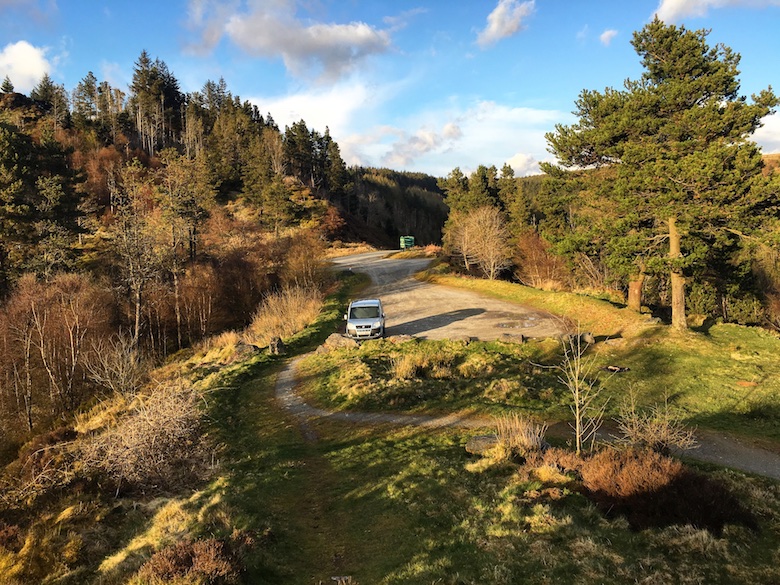
I nearly missed the turning from the busy A44 which links Aberystwyth and Llangurig, my eyes on the lovely Welsh scenery.  The slow procession of traffic building up behind an unknown driver in no hurry was soon left behind as I entered a much emptier world.  For five miles the single track road twisted and turned its way deeper into the hills, with the occasional rumble as I drove over a cattle grid.  At a fork in the road I turned left, descending towards the eastern arm of the sinewy Nant-y-moch Reservoir.  The road suddenly came to an end just before the outdoor centre at Maesnant, where I did a twelve point turn to get the vehicle pointing back the way I had come.  The car was deposited at a small pull in a hundred metres back down the road and I turned off the engine.  Opening the door and stepping outside I heard my favourite sound, silence.  I had arrived to explore what may be lost.

Day 1 – 7.1 miles with 430 metres ascent

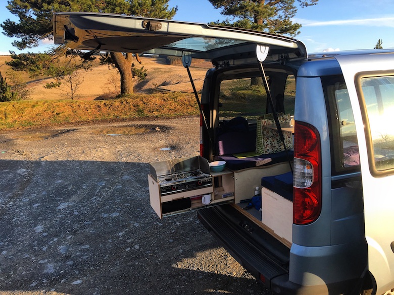
I was thankful that the area was deserted whilst I stood on one leg in my underpants, trying very indiscreetly to get changed out of my jeans.  I have to admit that I spent much longer than needed generally having a faff, aware that it was late and getting dark much earlier.  Reuben, occupying the back seat among piles of hair and slobber was very eager to get going.

There is something deeply satisfying about starting a walk into the middle of nowhere from the middle of nowhere.  You immediately feel free and the stresses of everyday life quickly start melting away.  With no sheep in sight Reuben started from the car with his lead tucked away in my rucksack pocket.  He relishes his off lead moments and decided to celebrate by doing his version of a forward roll.  This involves him running at full pelt before launching himself onto his back.

A good firm track heads from the end of the road towards one of my favourite Welsh Valleys, the Afon Hengwym.

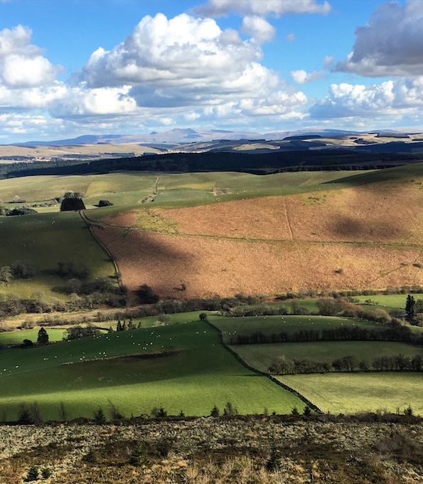
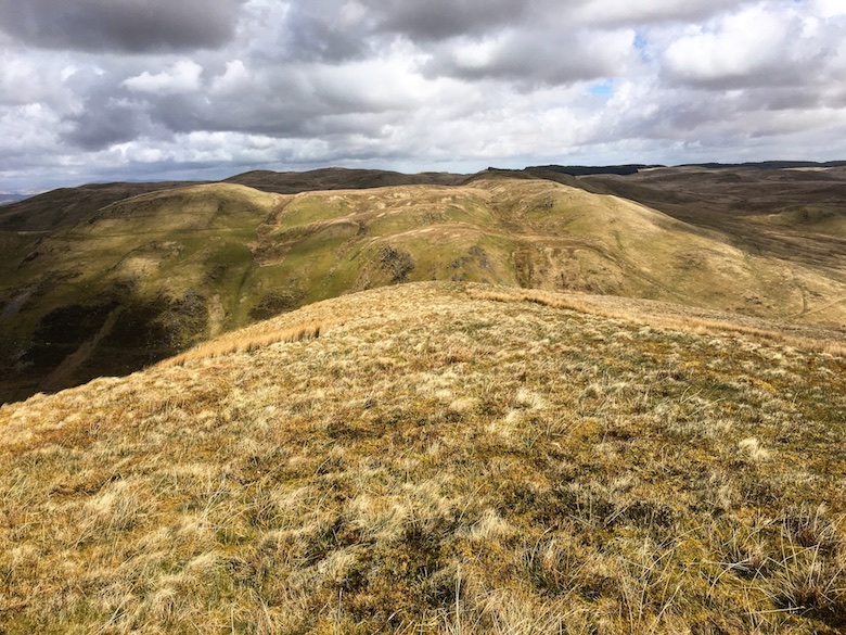
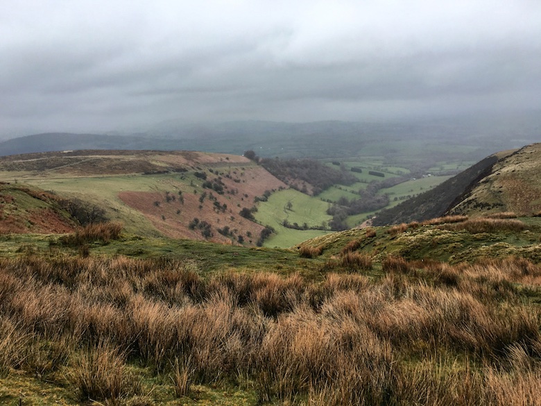
However I took a moment to look back across the tussock grass whispering gently in the breeze.  In the near distance was Drosgol, a lovely little conical hill that rises steeply above the reservoir.

My route was heading to the north of Drosgol, but a slender finger of the reservoir meant that I would have to take a lengthy detour to get there.  Therefore I continued walking in the opposite direction, a feeling of wildness growing with every step.

Just upstream from where the Hyddgen meets the Hengwm there is a footbridge, essential for a crossing after heavy rain.  I cast my eyes into the sublime valley of the Hengwm, a place of solitude barely touched by the hand of man.  A bridleway is marked on the map but this is often non-existent on the ground.  A ruined building further up the valley to me adds to its haunting beauty.  You know that feeling when you backpack in the Highlands of Scotland and are about to enter a really remote area?  There is an intangible feeling that you can’t really put a finger on.  That is how I felt when I first came here many years ago.  Geoff, the seeker of solitude with his excellent site v&g backpacking in Britain wrote this about the Hengwm, ‘Only at the bottom of the slope on a clear sunny morning did I appreciate the sense of scale of this empty valley, and in a strange way I felt more like a backpacker here than a hillwalker, if that makes sense‘.  If you pay a visit, it most definitely does makes sense!

Anyway, I am waxing lyrical about a valley I ended up not visiting on this backpack.  Sadly I turned my back on the Hengwym and headed west to cross the Hyddgen.  This river is unbridged at this point but thankfully water levels were low and I managed an easy wade across.  The aim was to contour the hill Banc Llechwedd-mawr along a non-existent bridleway.  I could see the line I wanted to take as it looked to be nice green grass.  The problem was that I had a series of deadly tussocks to cross to reach it.  Reuben for some reason loves this sort of terrain and he bounds up and down, taunting me whilst I lurch from step to step.  The view south across this sea of devil grass is towards Pumlumon, a cracking hill which is well worth a visit.

A climbing traverse of the hill soon brought me to a series of sheep tracks and I made good progress onto the shoulder of the hill.  The actual bridleway then made an appearance below me, somehow I had climbed too high.  A grassy prow made a good place to stop and contemplate my surroundings.  Below was a building that was in the process of being renovated.  It is in a truly lovely position and many years ago I camped next to it with a couple of friends.  Access is via a very long track which eventually leads to the mountain road from Tal-y-bont.  The owners have got themselves a cracking little place to escape.  But will they be able to escape there for long?  The map I have seen of the proposed Nant-y-moch wind farm shows that some of its many turbines will be pretty close to their little patch of heaven.

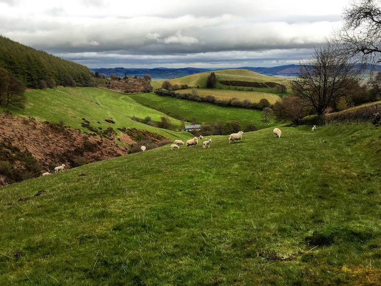
Rather than descending to the building and track, I continued to contour into the flat open expanse of the valley containing the Afon Llechwedd-mawr.  This is sheep country and as we reached the track I was aware that this would be one of Reubens sternest tests yet.  Whilst we marched the kilometre or so up the valley we were often no more than a few metres from a woolly creature.  Reuben although off lead was kept right by my side and he barely batted an eyelid as bundles of wool ran off in all directions.

It was a proud dog owner who forded the river into sheep free forestry for a hot slog through an area of disused mine workings.  Having a dog off lead in sheep country means constant vigilance, lots of talking and praise.  I have discovered that Reuben is fine when surrounded by sheep out in the open.  He only shows interest if we come across one by surprise, something I have to anticipate to avoid a chase situation developing.

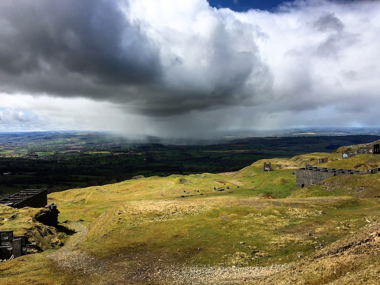
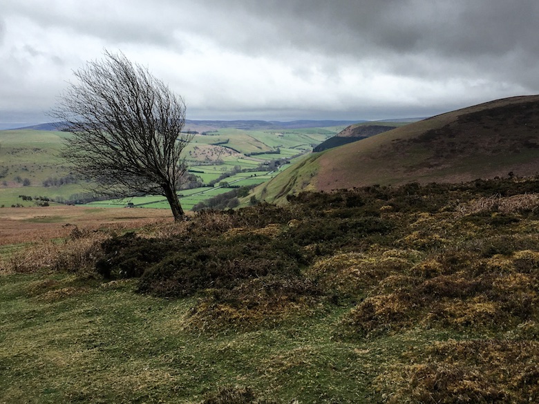
My destination for the night was the summit of Moel Y Llyn and I realised I had a way to walk and not much daylight left.  As I approached the minor mountain road the early evening light started doing magical things to the flat expanse of sea on the Horizon.

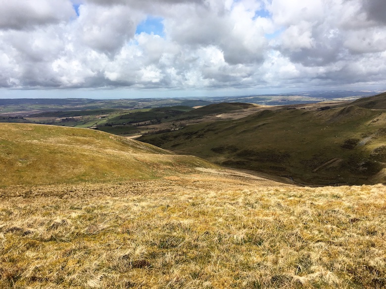
The tussocky grass once again slowed me down as I contoured the slopes, heading west towards the summit.  Tussocks mean nothing to an enthusiastic dog who suddenly gains a second wind, Reuben was again in his element doing doggie forward rolls.  I stopped for a while and glanced back at the way I had come, Pumlumon dominating the horizon.  In a few short years the landscape you see below may be covered in giant turbines.  Do you feel that this is a landscape worth saving?  I most definitely do.

I passed a stream flowing freely from the source marked on the map.  I didn’t fill my water bottles as there was another marked on the map closer to the summit.  I continued on to my chosen watercourse and found that it was bone dry.  A dilemma, do I backtrack 20 minutes to the last running water or do I take a risk by taking water from the Llyn on the summit?  Laziness won the day and I climbed to the summit without any fresh water.

It was much windier up there than expected and I spent a long while wrestling my Trailstar into a useable shape.  Once up it was solid but it was a minor ordeal getting there.  The Llyn was a short walk below the summit and I filled my bottles with surprisingly clear water.  I was glad that I had brought my Travel tap along with me, I would not risk drinking the water otherwise.  I returned to the Trailstar in the gloaming, the earlier promise of a sunset extinguished by a bank of cloud.

Day 2 – 10.2 miles with 650 metres ascent

I had a fitful nights sleep, still unused to being in an open shelter rather than a tent.  It was novel laying there with no barrier between my head and the dark night.  I slept badly because I was too hot, I had taken my winter sleeping bag, which only has a quarter length zip.  I woke up in a sweaty mess at 3.00am and checked the thermometer on my watch, it was still 17 celsius on a hill top on the 1st October!

The wind was still strong in the morning but it carried with it an unusual warmth.  Even at an early hour I was in a t-shirt.  With a hot drink in hand I took time to take in my surroundings and was mesmerised by fold after fold of hills disappearing into the distance.

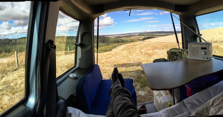
I have noticed on other outdoor blogs photos of the insides of the blog owners tent.  I have always admired the tidiness of these bloggers, my tent always resembles the aftermath of some out of hand party.  Things for me get even more out of hand in my Trailstar as there is not really a secure corner to pile things into.  Every time I need my lighter means a frantic ten minute search.  This is what a Trailstar looks like after Reuben and James have spent a night in it.

And looking out from Reubens perspective.

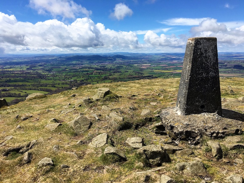
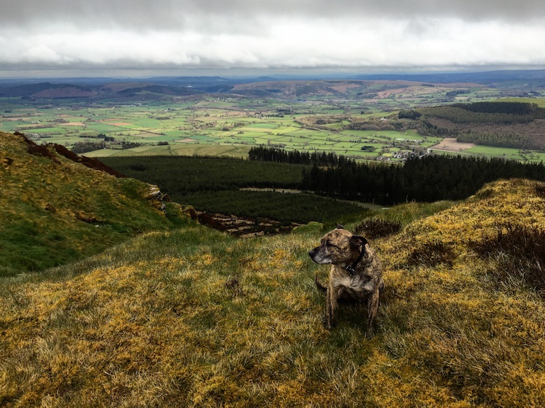
Thankfully it was easier to wrestle the Trailstar back into its bag than it was to set up.  We then walked to the trig point so that Reuben could do his usual celebration pose.

Rough ground was followed east over a series of minor hills, distant views now becoming rather murky in the very warm air.  Directly to the south over the shoulder of Pumlumon, movement caught my eye.  A few of the giant turbines of the Cefn Croes power plant were visible, a possible warning to what may come to this tranquil spot.  As I approached the forestry track there was a car parked and a couple sorting out their hiking kit.  I said hello to the woman nearest to me, rather strangely she acted like I simply was not there, no acknowledgement of my presence.  I did not exist.  When I have spent a while without human company this sort of reaction really pisses me off.  Mildly fuming as I walked away up the track I thought to myself, ‘do I look odd, is my willy hanging out, or was she just plain rude?’

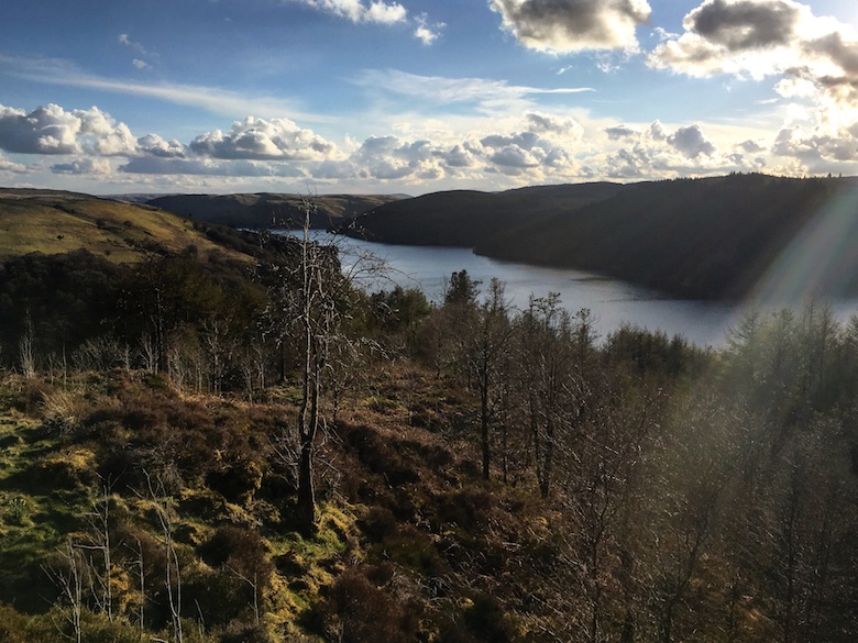
A couple of lakes soon lifted my spirits, first the New Pool, surrounded by forestry.

And then the much wilder Llyn Penrhaeadr.

I wanted to visit the waterfall of Pistyll-y-Llyn, tucked away in a spot well off the beaten track.  A right of way was shown on the map heading through forestry but this appeared to be the figment of the map makers imagination.  Instead I found a grassy swathe of cropped grass that followed some concrete posts, possibly belonging to the water board.  At the top of the hidden falls I found a ledge to perch and take in the stunning views north towards Snowdonia.

With shoes and socks off, plenty of food and water, heat and a good breeze, an hour passed very quickly.  Reuben as usual was happy to take the opportunity to spread out and take in the sun.

Once again the day was slipping away and I still had some mileage to do.  The climb up to Moel Hyddgen seemed to go on forever, it was only the views from the edge of the plateau that kept me going.

It was here that my left foot started to get really painful, the outside edge unable to support my full weight.  I began to wonder if all the rough ground I had crossed in my trail shoes had contributed to my discomfort.  I had done a lot of traversing the day before on steep and rough slopes.  As I walked along the track towards the Hyddgen valley I fell into a fugg of self-pity.  It was hot with no breeze and my water was running low.  My foot hurt making progress slow, and to top it off my rucksack developed an annoying squeak from the shoulder straps.  Limp, squeak, limp, squeak, limp, squeak………………..

The track gradually descended to the cool of the forest and I came across what I felt was a bit of a contradiction.  On a fence post was an ancient walkers welcome sign.  The fence post was next to a large six-foot high forestry gate which was firmly locked, blocking the track.  Reuben had to be manhandled over the obstacle, to be unceremoniously dumped on the other side.

At a junction of tracks there was a sound that is familiar in the Mid-Wales hills, the roar of trailbikes.  A large group of them passed in a cloud of dust, the sound echoing around the hills for ages as they descended into a valley.  My route climbed once more, passing another locked gate, even though I was now on a bridleway.

My destination for the night was the summit of Foel Uchaf, unfortunately located a mile across trackless bog.  With tiredness, thirst and a painful foot it felt like the crossing took forever.  I also began to doubt if the water source I had chosen would be flowing.  Darkness was also less than half an hour away.  Reuben however after lagging behind during the heat of the day had once again found his second wind, tearing through the bogs like a dog possessed.  Although the walking was difficult there was a beauty to the grimness, with endless shades of yellow, red and brown.

Thankfully the watercourse was flowing and I climbed to the summit of Foel Uchaf fully laden with 5 litres.  Darkness was coming quickly and I pitched the Trailstar in the diminishing light.  Thankfully as darkness came the strong wind dropped leaving a gentle breeze, the clouds cleared and the stars came out.  Reuben was totally knackered, he found a spot in the shelter before I had finished unpacking, turned round in a circle a few times and promptly started snoring.  I enjoyed being alone on a dark hillside in the middle of nowhere and it was still warm enough to just wear a t-shirt.  I spent a while outside playing with my camera before settling down for the night.

Day 3 – 3.4 miles with 130 metres ascent

My plan was to climb Pumlumon on the way back to the car.  However I managed to develop a lethal dose of lethargy which meant that it was almost midday before I even contemplated packing up.  Sometimes it is nice to simply ‘be’ when in the hills.  I was already pitched on a summit so did not feel the urge to visit the larger one situated behind my shelter in the photo below.

Reuben also did not seem that keen to move, he lounged in the cavernous shelter, snug in his fetching jacket.

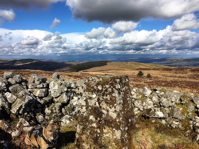
The lethargy did eventually have to be broken as it was impossible to reach the car without involving at least a small amount of effort.  A quick visit to the cairn on the summit where we had slept was in order for a view of the extensive rolling moors.

The twin cairns on Carn Gwilym are a dominant feature of the area.  The descent and re-ascent seemed further on the ground than it did on the map.  On close inspection the cairns are magnificent structures and there are great views down into the bleak and isolated Hyddgen valley.

To the south of the hill there was a grassy undulating ridge with Nant-y-moch framing the horizon through the gathering murk.  Reuben celebrated the last high point of the weekend by showing off what a good job the vet had done by removing all trace of his doghood.  We were soon down in the valley to return along the track back to the car.

If you have managed to get to the end of this lengthy post, I hope that you would agree that this area is rather special.  It is and I urge you to visit.  If you get your kicks from rocky mountainous places then I suggest you give it a miss as you may be disappointed.  However if you enjoy solitude amongst some subtle but rather lovely hills I suggest that you go now before it has gone forever.

And if you have not signed these two petitions, please do.

http://www.gopetition.co.uk/petition/33775.html

http://www.gopetition.com/petitions/no-to-the-industrialisation-of-mid-wales.html

And a website worth checking out:  http://www.nonantymochwindfarm.co.uk/