


I had planned to spend the weekend with my feet up doing nothing. However the forecast was for the first warm weekend of the year. There was nothing for it other than to pack the Mountain Staffy into the Bongo and head for the hills. Shropshire is only a hundred miles from Nottingham, an easy drive if Birmingham was not in the way. I had no real plans, a couple of hills and time to kick back in the van and enjoy a good book.
The Stiperstones – 536m
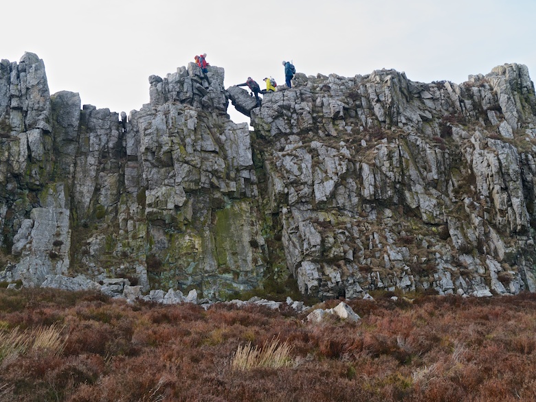
It is many years since I walked amongst the jagged tors on the summit of the Stiperstones. These rise like armoured plates on the back of a dinosaur from the broad heather clad ridge. It was early afternoon when we arrived at the car park, so I settled on a short circular walk. A low-level path followed by an exploration of the ridge itself. There are some great scrambling opportunities on the Devil’s Chair and I spent a while watching a group gingerly pick their way across the narrow ridge. With Reuben in tow I had to make do with a rocky perch to watch the world go by instead.
The last tor of the day was Cranberrry rock where we surprised a family who had scrambled up. They did not expect to be greeted by a hound. I have to say that I was impressed by the scrambling abilities of the two small folk, with parents happy to let them have a go.
By the time that we got back to the Bongo the car park was busy with people out for an evening stroll. It would have been a good place to spend the night but I was keen on a bit of solitude, so the Bongo was headed in a westerly direction.

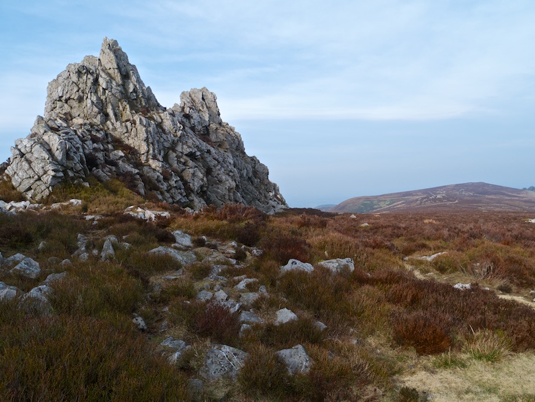

Mitchell’s Fold stone circle and Stapeley Hill – 403m
A bumpy potholed track leads to a small car park a couple of hundred metres from the road to Priest Weston. A perfect spot in which to sleep in the Bongo for the night. Fortified by a cup of coffee I set off once more with Reuben, this time into the soft light of early evening. The stone circle occupies an atmospheric spot with Corndon Hill as a backdrop.
The light was getting better and better as the sun began its descent towards the horizon. The summit of Stapeley Hill looked like a worthy destination to watch the day fade into night. On the way we passed a guy walking his dog on a flexi lead, Reuben also being on one. Within a few seconds there was a tangle of dog and lead when Reuben got too enthusiastic with his greeting.
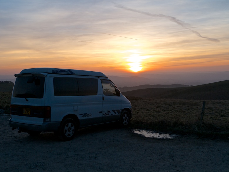
Back at the van I spent a comfy night with a good book and piles of food.


Corndon Hill – 513m
I had left the privacy screen off the Bongo’s windscreen. This meant that I woke to a panoramic view from the comfort of my bed. Layer after layer of hills spreading into Wales.
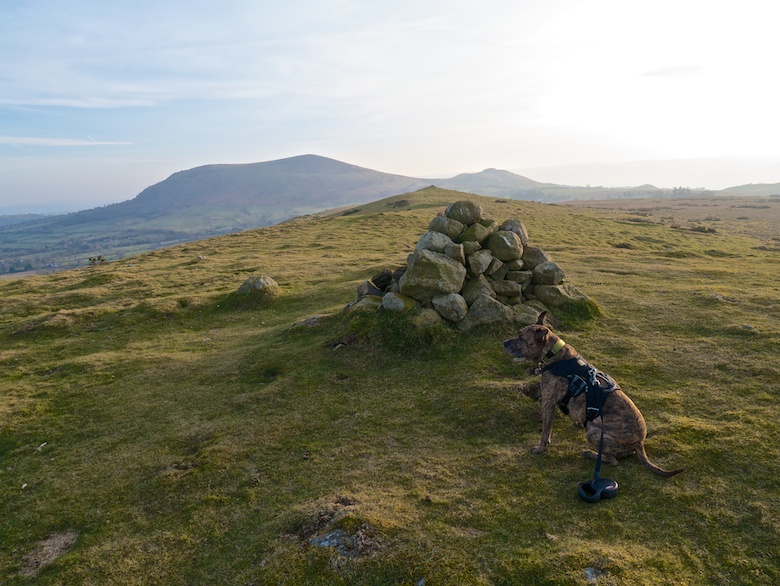
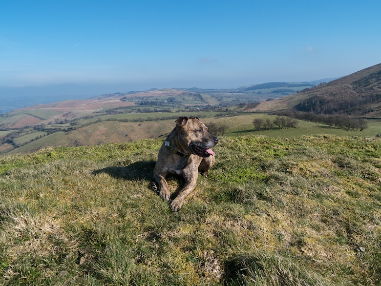
The shapely cone of Corndon Hill has often caught my eye when in the area, one I have long been keen to climb. The car park where I had spent the night was an ideal launching pad. We did a short and sharp circuit taking in the neighbouring Lan Fawr.
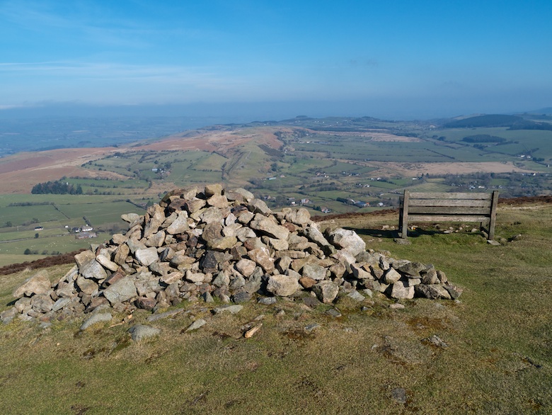
Corndon Hill is a superb viewpoint, seemingly taking in half of Wales. There is even a handy bench on which to take it all in. Definitely high on the list of hills with big views for little effort. A spot for a mid summer bivvy maybe?
Heath Mynd – 452m
I had planned to drive home after Corndon Hill in an attempt to miss the Sunday afternoon M6 rush. However another shapely hill had caught my eye. My map showed that it was Heath Mynd, located on a small parcel of access land.
I initially tried to get onto the access land from the north. However the track that led onto it through pastures has a very large sign pointing out that it is private. I was not in the mood for any form of confrontation so headed south in the van so attempt it from there. The lanes were so narrow and knackered that I began to wonder if I was actually driving down a farm track at one point. Parking proved to be difficult, I eventually squeezed the Bongo onto a small grassy patch off the road.
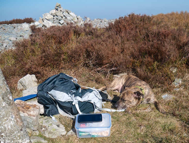
The hill itself was a simple climb, initially through grassland before knee-deep heather on the summit. It was surprisingly warm and I sat in a t-shirt to eat my lunch, Reuben enjoying the sun.
Sadly I did get caught in the Sunday afternoon rush on the M6. Worth it for a couple of unplanned days in the sun.
